
U24 Safety to Sorrento
- Feb 13, 2027
- Distances from 6km to 24km
At a glance
- Next edition date
- February 13, 2027
- Distances
- 6 km · 12 km · 24 km
- Where
- Sea · Safety Beach to Sorrento foreshore, Sorrento, Victoria, Australia
- Entry fee
- 6 km: 199 AUD · 12 km: 409 AUD · 24 km: 575 AUD
- Wetsuit
- Wetsuits are permitted; swimmers must nominate 'assisted swim' during registration if wearing one.
- Registration
- u24.com.au
About the race
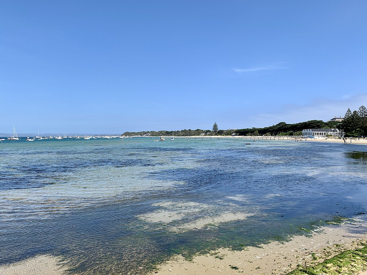
The U24 Safety to Sorrento is an open water swimming race held in the sea of Port Phillip Bay on the coast of Victoria, Australia. Organized by Neverland Enterprises Pty Ltd trading as SwimWell, the event is held every year in February. Swimmers start at Safety Beach and finish on the Sorrento foreshore, with entry options featuring course distances of 24 kilometres, 12 kilometres, and 6 kilometres. Rather than dealing with crashing ocean surf or unpredictable waves, the swim takes place in the calm and expansive waters of the bay, offering a course focused on personal mindset and consistent pace. The water temperature in Port Phillip Bay during the February event typically settles between 19 and 23 degrees Celsius.
These waters are inhabited by diverse marine species including dolphins, seals, rays, octopuses, sea urchins, and jellyfish. Tackling such an endurance marathon requires careful preparation and dedicated support. The minimum age for all swimmers is 18 years at the date of entry. Swimmers entering the solo and tandem 24-kilometre categories must provide qualifying information before participating. By contrast, no qualifying swim is required for the 12-kilometre and 6-kilometre events. Every swimmer must have an accompanying support paddler alongside them in the water, as well as at least one individual acting as land support present on shore. Wetsuits are permitted, requiring entrants to nominate the assisted swim category at registration. The event operates under a cut-off time of 9 hours from the start, and every swimmer who finishes their registered distance is awarded a medal, certificate, and merchandise.
Portsea Hole and the drowned Yarra River bed
Off the coast, Portsea Hole forms a distinctive feature of the bay's underwater terrain. Located approximately 500 metres from the Portsea Pier, this 10-hectare depression in the seafloor of Port Phillip is a remnant of the drowned Yarra River valley. Swimmers and divers exploring the area encounter a sheer drop, where the depth of the seafloor falls from 12 metres down to 32 metres. The limestone sides of the depression reveal changes in geological strata, and a vertical wall 75 metres long with small overhangs lies to the north of the site. Further along the headland, Point Nepean marks the southern entrance to Port Phillip, a passage known as The Rip.
The Rip forms a triangular waterway between Point Nepean, Shortlands Bluff, and Point Lonsdale. The navigable width of the entrance is reduced to just 1 kilometre by reefs projecting outward from the headlands. Depths in the entrance range from 90 metres inside the heads to less than 5 metres over shallow rocky reefs, while tidal streams through the channel can reach speeds of up to 6 knots. Because of these turbulent conditions, the passage is considered one of the ten most dangerous navigable passages in the world, having claimed ships such as the Sacramento in 1853 and the Cheviot in 1887. Human settlement around Point Nepean reaches far into the past, with Aboriginal presence dating back 40,000 years.
The Point Nepean Quarantine Station opened in 1852 and preserves the oldest buildings erected for quarantine purposes in Australia. To guard the approaches, coastal fortifications with gun batteries were installed at Fort Nepean in 1886, Eagles Nest in 1888, and Fort Pearce in 1911. Maritime hazards persisted into the twentieth century, including the SS Petriana wreck off Point Nepean in 1903, which caused Australia's first major oil spill. Below the surface, the coastal environment features intertidal reef platforms and subtidal reefs populated by fish, sponges, and bryozoans. Across the channel, navigation through the heads has long been guided by the Queenscliff Low and High Lights alongside the Hume and Murray Towers.
The Queenscliff Low Light sits at the eastern end of the Bellarine Peninsula, situated about 10 kilometres from the race area and overlooking The Rip. The original light station was established in 1854 using a prefabricated wooden lighthouse, with lamp and housings manufactured in England by Chance Brothers. That wooden tower was dismantled in 1863 and relocated to Point Lonsdale, while the light itself was later converted to gas in 1890 and to electricity in 1924.
South Channel Fort and the Chinaman's Hat seal platform
Out in the southern reaches of the bay, historic structures mark the open shipping channels. About 4 kilometres from the race area, the South Channel Pile Light was constructed between 1872 and 1874 to assist vessels navigating the South Channel. The lighthouse served as a navigational beacon for 111 years before ceasing operations in 1985, after which Parks Victoria restored the structure in 1998 and moved it to a position three kilometres off the coast of Rye Beach. About 7 kilometres from the race area lies South Channel Fort, an artificial island covering 0.7 hectares in southern Port Phillip. The island was constructed in the 1880s using 14,000 tonnes of bluestone boulders, concrete, and sand on a shoal, designed to illuminate the shipping channel and control underwater mines to stop attacking ships.
The rocks surrounding the fort support kelp forests, sponges, soft corals, and invertebrates, while the island serves as a breeding site for the white-faced storm-petrel and receives visits from little penguins, black-faced cormorants, and Australian fur seals. About 6 kilometres from the race area stands Chinaman's Hat, an octagonal structure in the South Channel used as a shipping marker and seal haul-out. The site formed part of the Port Phillip defence system during World War II, using underwater indicator loops to detect submarines. The original military installation rested on a concrete caisson base 7 metres in diameter on a sandy shoal 6 metres below the waterline. In 2002, Parks Victoria built the current platform at a cost of 210,000 Australian dollars near the Mud Islands bird sanctuary, where it is occupied by a bachelor community of Australian fur seals.
About 9 kilometres from the race area, the Mud Islands consist of three low-lying landmasses surrounding a 35-hectare shallow tidal lagoon. Sand movement driven by tidal currents constantly alters the configuration of the islands. Lieutenant John Murray discovered them in February 1802 and initially named them the Swan Isles, before Lieutenants T.M. Symonds and H.R. Henry of HMS Rattlesnake surveyed and renamed them Mud Islands in 1836. The islands host one of the largest colonies of crested terns in Victoria and provide a breeding ground for approximately 5,500 white-faced storm-petrels that nest in burrows in the sand.
The Mornington Peninsula foreshore from Safety Beach to Sorrento
Along the shoreline, the 25-kilometre Bay Trail follows the Port Phillip coastline, bordered by sandy beaches and clear waters. Numerous colourful bathing boxes line the sand along the trail. The foreshore reflects long chapters of local history. At Dromana, established as a seaside resort by 1881, the pier was historically used by steamships. At Whitecliffs, an historic lime kiln commemorates the 19th-century limestone mining industry. Nearby Sullivan Bay marks the site of the first official European settlement of Victoria, established in 1803. The final approach leads into Sorrento, which sits atop 20-metre-high calcarenite bluffs. Sorrento's beaches are narrow and steep, fronted by wide tidal flats that are exposed at low tide. Reaching the Sorrento foreshore across these shallow flats brings the marathon journey to a close on the sand.
The marked line from Safety Beach to Sorrento
U24 Safety to Sorrento swimmers must remain on the course and stay inshore of the 5 knot boating poles at all times. Swimmers and paddlers go around all piers and jetties on the route except the Blairgowrie yacht squadron infrastructure, where specific instructions apply. The route is planned each year to include some tidal assistance for the swimmers. Start times at Safety Beach vary from year to year because the course is strongly affected by tidal variation. The U24 cut-off is nine hours, because the tide changes after that time and the organisers consider it unsafe to keep swimmers in the water beyond it. Team swims on the U24 course can only change over at three designated change-over areas.
Sources: South Channel Pile Light · Portsea Hole
Course
Open water swim starting at Safety Beach and finishing on the Sorrento foreshore. Swimmers must remain in-shore of the 5-knot boating poles and follow the course marked by pink buoys, navigating around piers and jetties.
Open water swim starting at Safety Beach and finishing on the Sorrento foreshore. Swimmers must remain in-shore of the 5-knot boating poles and follow the course marked by pink buoys, navigating around piers and jetties.
Open water swim starting at Safety Beach and finishing on the Sorrento foreshore. Swimmers must remain in-shore of the 5-knot boating poles and follow the course marked by pink buoys, navigating around piers and jetties.
Awards
- Wetsuit/No-wetsuit separated
This is a timed event, not a race. No individual rankings are prepared. All finishers receive a medal, certificate, and merchandise.
How to get there
U24 Safety to Sorrento
Frequently asked questions
- When is U24 Safety to Sorrento?
- U24 Safety to Sorrento takes place on February 13, 2027.
- What distances does U24 Safety to Sorrento offer?
- U24 Safety to Sorrento offers 6 km, 12 km, and 24 km.
- How much is the entry fee for U24 Safety to Sorrento?
- Entry fees by distance: 6 km: 199 AUD · 12 km: 409 AUD · 24 km: 575 AUD.
- Is a wetsuit required at U24 Safety to Sorrento?
- Wetsuits are permitted; swimmers must nominate 'assisted swim' during registration if wearing one.
- Where does U24 Safety to Sorrento take place?
- U24 Safety to Sorrento is a sea swim. Location: Safety Beach to Sorrento foreshore, Sorrento, Victoria, Australia.
- How do I register for U24 Safety to Sorrento?
- The reference page for registering for U24 Safety to Sorrento is https://www.u24.com.au/terms-conditions.
Where to stay
Sorrento offers a range of stays from heritage-listed limestone cottages to boutique hotels overlooking the bay. For those seeking proximity to the finish line, self-contained apartments near the main pier are common, while camping options are available just outside the town center. Expect to budget between $250 and $550 per night during the peak February season, with prices scaling based on proximity to the water.
Things to do nearby
The Mornington Peninsula is defined by its cool-climate viticulture and coastal topography. Between swims, you can explore the local cellar doors for cool-climate pinot noir, navigate the coastline via kayak or SUP to reach secluded spots, or hike the coastal trails of the Point Nepean National Park. For history enthusiasts, the area hosts several sites documenting early colonial settlement and maritime defense structures.
Swimmers
Similar races


Comments
Transparency: some links on this page (stays, flights, experiences, gear) are affiliate links — if you book or buy through them, Omniathlon may earn a commission from the partner at no extra cost to you. As an Amazon Associate we earn from qualifying purchases.