
Travesía a Nado de las Hoces del Duratón
- May 24, 2026
- Last edition date
- Distances: 1.5km and 3.8km
At a glance
- Last edition date
- May 24, 2026
- Distances
- 1.5 km · 3.8 km
- Where
- River · San Miguel de Bernuy, Castilla y León, Spain
- Entry fee
- 40–65 €
- Wetsuit
- Wetsuit use was required due to low water temperatures, especially near the start area.
- Registration
- cdtriatlonlacerta.es
About the race
The Travesía a Nado de las Hoces del Duratón, Memorial Alberto Vitón is an open water swimming race held in the freshwater reaches of the Duratón River at San Miguel de Bernuy, in the province of Segovia, Castilla y León. Entering the water in this quiet stretch of central Spain offers an intimate encounter with a river that has shaped local life, legend, and geology across millennia. Both the starting line and the finish are staged right by the riverbank in the Robledal recreation area of San Miguel de Bernuy. Swimmers line up under the riverside trees before pushing off into the clear, slow-moving river current. The event offers two challenging distances, a 1,500-meter course and a longer 3,800-meter crossing, each allowing participants to pace their effort against the gentle flow of the Duratón.
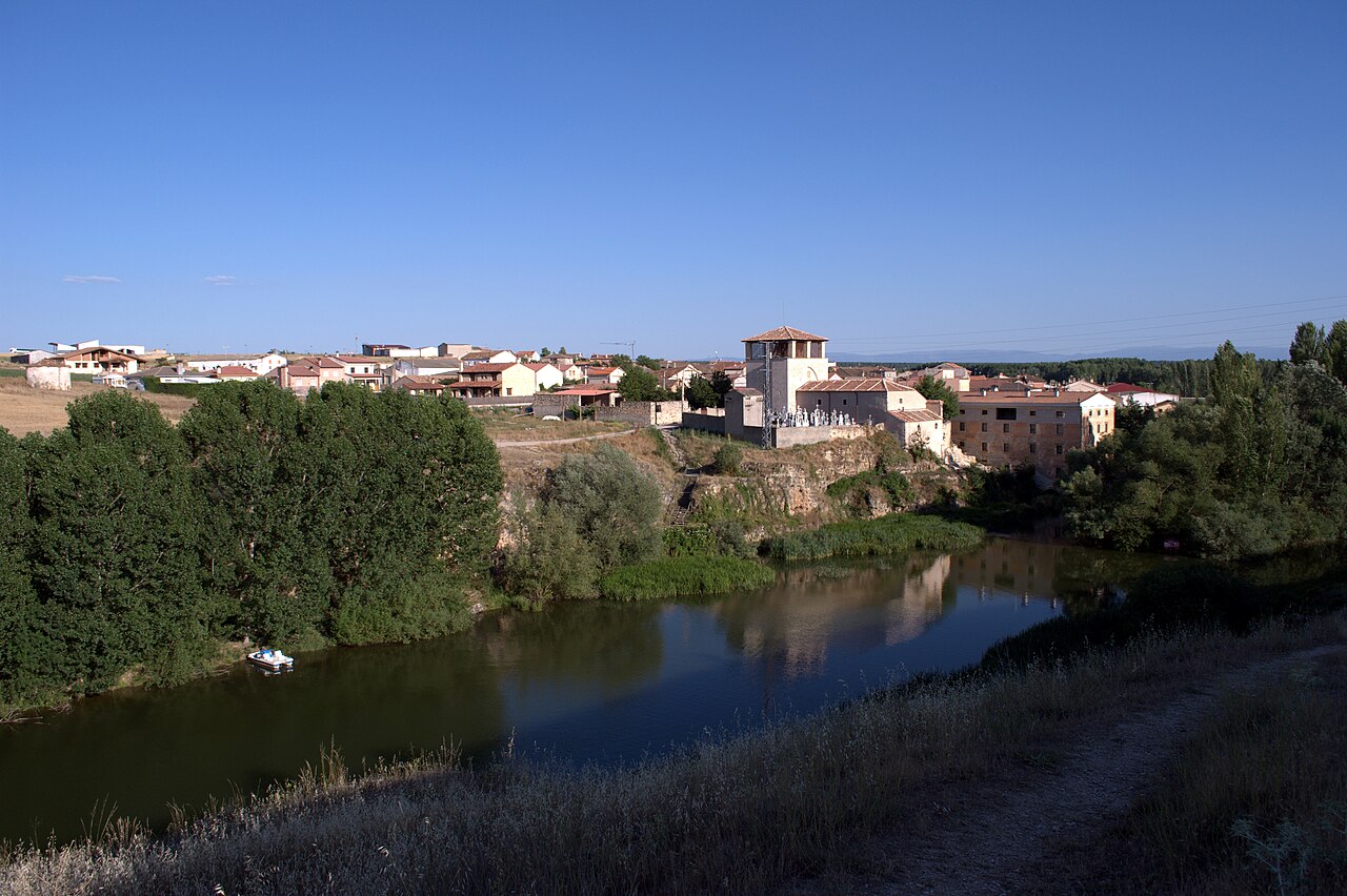
Organizers require all participants to wear a wetsuit. Slipping into neoprene provides both necessary thermal insulation and helpful buoyancy over the distance, letting swimmers focus entirely on rhythmic stroke mechanics and sighting. Organized by the local club C.D. Triatlón Lacerta, the competition serves as a heartfelt sporting tribute in memory of Alberto Vitón, drawing dedicated open water swimmers to Segovia every May.
Hoces del Duratón: 140 million years of limestone and water
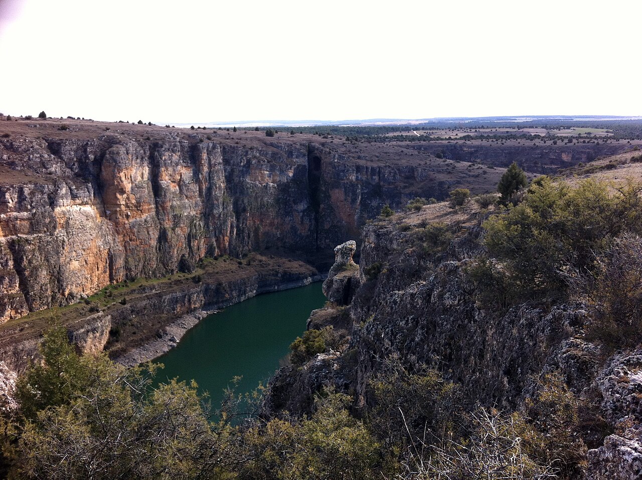
About seven kilometres from the race venue, the river gives rise to the dramatic landscapes of the Parque natural de las Hoces del Río Duratón, where the channel has cut a deep canyon through limestone bedrock between the towns of Sepúlveda and Burgomillodo. These massive sedimentary layers formed approximately 140 million years ago during the Mesozoic Era from accumulating marine sediments. Over untold millennia, carbonic acid dissolved the limestone matrix through continuous karst processes, creating an intricate subterranean labyrinth of caves, deep fractures, and karst sinkholes throughout the river valley. Water and wind gradually hollowed out softer horizontal rock layers situated directly below harder limestone strata, creating distinctive cavities and shelters known locally as balmas.
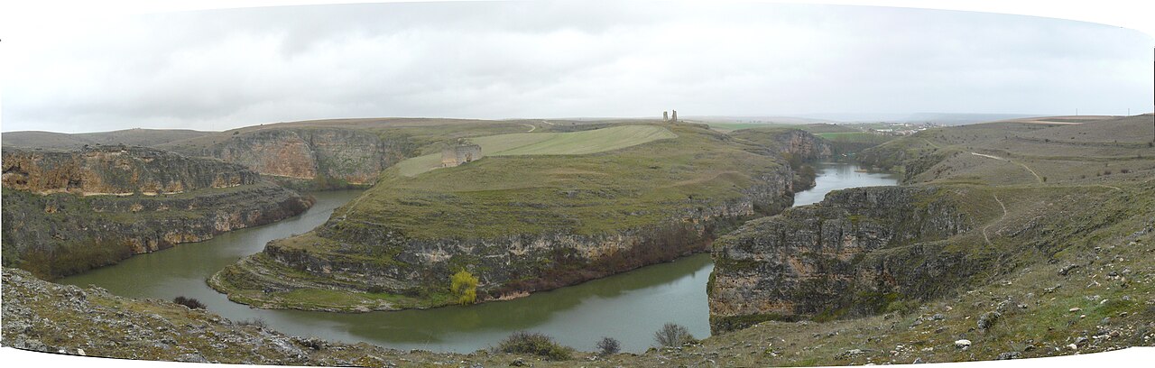
These naturally sheltered recesses provided practical refuges for early human settlements and continue to offer secluded nesting pockets for wildlife. The park environment itself is divided into three distinct ecological zones: the dry, windswept high plateau, the sheer vertical cliffs, and the sheltered riverside forest along the water level. Down on the canyon floor, the river nurtures a dense and vibrant riparian gallery forest.
San Frutos and the submerged ruins along the Duratón
About six kilometres from the race area, the ancient Cueva de los Siete Altares sits recessed into the rock cliffs just 100 meters upstream from the bridge crossing the Duratón River. Bounded to the east by the Barranco stream, this natural cavern served as an early hermitage and was carved into an enduring rock church featuring authentic Visigothic horseshoe arches. About seven kilometres away, perched upon a rugged promontory encircled by a tight meander of the river, stands the historic Ermita de San Frutos. The isolated monastery overlooks sweeping panoramas of the gorge and the waters of the nearby Burgomillodo reservoir.
Visitors reach the monastic sanctuary by crossing a stone bridge erected in 1757 over a sheer chasm known as La Cuchillada, leading directly toward anthropomorphic graves carved into the solid rock at the base of the church apse. The original Embalse de Burgomillodo dam built in 1929 introduced an innovative siphon chamber spillway used for the first time anywhere in Spain, before being superseded by the current 44-meter-tall barrier with its two discharge spillways capable of handling up to 400 cubic meters per second. When the reservoir filled in 1953, it submerged the lower gorges and cut off historic walking trails leading to the Convento de Nuestra Señora de los Ángeles.
Local lore tells that Saint Frutos concealed the convent's revered Virgin image in 711 or 714 to protect it from advancing Muslim forces, long before a violent storm caused the monastic quarters to collapse on September 7, 1492. Today, the romantic lakeside ruins remain accessible almost exclusively from the water, emerging only on foot when the reservoir level recedes.
Lagunas de Cantalejo and the San Juan river confluence
Water continues to shape the surrounding Segovian landscape well beyond the main river canyon. About five kilometres from the starting line, the San Juan River flows past the hamlet of San Miguel de Neguera to join the Duratón, entering the natural park along its final kilometres. Documents dating back to 1076 record an ancient crossing point known as the ford of Neguera, highlighting the strategic importance of this waterway through centuries of settlement. Rising in the Carpetanos mountains near Peña Quemada, the San Juan flows past Castilnovo castle and belongs to the greater Duero basin, carrying its current ultimately toward the Atlantic Ocean. Deep within the natural canyon of the San Juan stands the historic Palacio de los González de Sepúlveda, an evocative complex that incorporates an old water mill built right beside the flowing stream.
Like many mountain-fed currents in the region, the San Juan has seen dramatic surges over time, including a memorable historic flood recorded on May 24, 1853. Just seven kilometres from the race zone, the terrain shifts into the protected wetland realm of the Lagunas de Cantalejo. Spanning over 12,000 hectares, this preserve holds the distinction of being the only wetland ecosystem in Spain situated entirely within continental sand dunes. Designated both as a Site of Community Importance and a Special Protection Area for Birds, the shallow pools provide vital sanctuary for majestic black storks, marsh harriers, and the vulnerable Spanish imperial eagle. During the seasonal migrations, flocks of common cranes touch down beside resident little grebes, common redshanks, and coots paddling along the reedy banks. Heading into the cool, sheltered waters on race morning allows swimmers to experience the very hydrological pulse that sustains this rich and timeless haven.
Sources: Cueva de los Siete Altares · Río San Juan (Segovia) · Palacio de los González de Sepúlveda · San Miguel de Neguera
Course
Start and finish located in the 'Robledal' area of the Duratón river.
Start and finish in the 'Robledal' area, extending up to the entrance of the Vencías de Fuentidueña reservoir.
Previous editions
- 2025results
How to get there
Travesía a Nado de las Hoces del Duratón
Frequently asked questions
- When was the last edition of Travesía a Nado de las Hoces del Duratón?
- The last edition of Travesía a Nado de las Hoces del Duratón took place on May 24, 2026.
- What distances does Travesía a Nado de las Hoces del Duratón offer?
- Travesía a Nado de las Hoces del Duratón offers 1.5 km and 3.8 km.
- How much is the entry fee for Travesía a Nado de las Hoces del Duratón?
- The entry fee ranges from 40 € to 65 €.
- Is a wetsuit required at Travesía a Nado de las Hoces del Duratón?
- Wetsuit use was required due to low water temperatures, especially near the start area.
- Where does Travesía a Nado de las Hoces del Duratón take place?
- Travesía a Nado de las Hoces del Duratón is a river swim. Location: San Miguel de Bernuy, Castilla y León, Spain.
- How cold is the water at Travesía a Nado de las Hoces del Duratón?
- The organizer states a water temperature of 19 °C (66 °F).
- How do I register for Travesía a Nado de las Hoces del Duratón?
- The reference page for registering for Travesía a Nado de las Hoces del Duratón is https://cdtriatlonlacerta.es/450596508/aguas-abiertas.
Where to stay
San Miguel de Bernuy offers a quiet base for the race weekend, with most participants opting for traditional rural houses or converted village lodgings that retain the character of the region. Nearby, simple camping areas near the riverbanks provide direct access to the water for early morning acclimatization. Boutique options are limited, focusing instead on authentic regional hospitality. You can expect to find double rooms ranging from €60 to €110 per night during the late spring season, depending on the proximity to the river access points.
Things to do nearby
Beyond the race, the Duratón area is best explored through its natural and historical heritage. The river gorges are a prime location for kayak and SUP excursions, allowing you to see the canyon walls from the water level. For those staying on land, the surrounding trails offer extensive trekking paths that lead to panoramic viewpoints overlooking the hermitage of San Frutos. Local gastronomy remains rooted in the tradition of Segovia, with many small villages nearby offering tastings of regional roasted meats and local wines.
Swimmers
Similar races


Comments
Transparency: some links on this page (stays, flights, experiences, gear) are affiliate links — if you book or buy through them, Omniathlon may earn a commission from the partner at no extra cost to you. As an Amazon Associate we earn from qualifying purchases.