
Somes Island Challenge
- Mar 7, 2027
- Distances from 500m to 5km
At a glance
- Next edition date
- March 7, 2027
- Distances
- 500 m · 1.3 km · 2.5 km · 5 km
- Where
- Sea · Oriental Bay, Petone, Wellington, New Zealand
About the race
At the wharf of Matiu / Somes Island, swimmers step off the ferry not as casual day-trippers, but to plunge straight into the waters of Wellington Harbour and swim all the way back to the mainland. The Somes Island Challenge is an open water sea crossing held across Wellington Harbour to the sandy shore of Petone, in the Wellington region of New Zealand. The morning begins with an outbound boat journey across the harbour, giving competitors time to study the expanse of open water and take in the historic landmarks of the bay before lining up at the island wharf. Stepping off the pontoon, swimmers face a direct line pointing straight toward the distant beach of Petone.
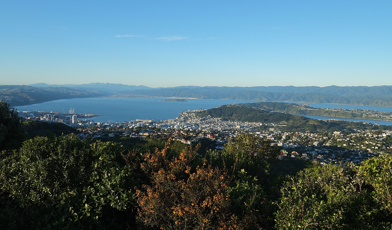
Rather than turning around a protected loop of marker buoys, the crossing is a straight shot across exposed harbour swells that demands solid open-water navigation and sustained endurance. The deep water here is driven by active tidal flows and whipped by the brisk winds funnelled through Cook Strait, creating a shifting chop that tests rhythm and sightlines with every stroke. Because of these open-water elements, organizers consider the traverse suited to moderate-to-experienced swimmers who are comfortable holding their heading in deep marine conditions. The signature distance is the 3.2-kilometre point-to-point challenge from the island wharf to the mainland foreshore. Organized by Swimming Wellington, the wider event programme also incorporates distances of 500, 1,250, 2,500, and 5,000 metres, catering to swimmers looking for various tests in the harbour water.
Matiu and Mokopuna: sanctuary islands at the start
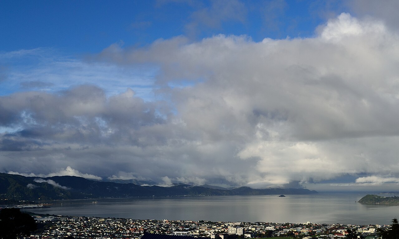
Just fifty metres across a narrow marine channel sits Mokopuna Island, a petite companion landmass measuring barely two hundred metres by eighty. Mokopuna is protected today as a strict scientific reserve where all landings are entirely prohibited. Its coastal caves carry strange human stories from the turn of the twentieth century. In 1904, a man diagnosed with leprosy was quarantined on Mokopuna and lived inside one of the coastal caves for three months, surviving on supplies winched across the fifty-metre gap from Matiu by a flying fox. Today, the island serves as a secluded ecological sanctuary; back in April 1920, six tuatara were released across its soil.
The Waiwhetu Aquifer: freshwater springs beneath the harbour floor
Swimmers navigating the harbour surface are cutting directly over a drowned prehistoric landscape. Twenty thousand years ago, during lower sea levels, the ancient riverbed of the Hutt River flowed openly through an exposed valley along a paleochannel running just to the east of Matiu / Somes Island. As ancient ice melted and ocean levels rose, the marine waters flooded the valley, burying the original river gravels deep under sea sediment. Trapped beneath those seabed gravels lies the Waiwhetu Aquifer, an enormous pressurized artesian reservoir of water-retaining sand, gravel, and boulders that supplies forty percent of the drinking water consumed across the Wellington region. Deep on the harbour floor, hundreds of small depressions known as pockmarks allow this cold, pure artesian water to bubble upward through several hundred submarine freshwater springs, perpetually feeding the ocean from underneath.
The tremendous natural pressure hidden within this submerged reservoir was demonstrated dramatically in 1929, when pile drivers constructing a wharf at Point Howard accidentally punctured the aquifer cap, unleashing a powerful underwater freshwater geyser. A few years later, in 1937, industrial dredging near the mouth of the river bed caused another abrupt drop in aquifer pressure that reverberated through the Hutt Valley wells. Swimming across the bay, you are gliding right over this hidden subterranean river system pulsing beneath the saltwater floor.
Wellington Harbour: kelp forests, penguins and harmless sharks
Beneath the surface chop, Wellington Harbour nurtures a rich marine habitat anchored by more than one hundred species of seaweed, including extensive kelp forests clinging to rocky headlands. Watching out for birds diving around you is one of the rewards of swimming in these cool southern waters. While historical beach accounts from the late nineteenth century occasionally recorded the sight of dorsal fins out in the warmer eastern shallows, the sharks visiting Wellington Harbour today are rig sharks that slip into the shallows every year solely to mate and give birth. In nearby protected inlets such as Whairepo Lagoon, graceful eagle rays regularly glide along the sandy shallows. Seals are a frequent sight basking along the outer rocky coastline, and lucky observers in the harbour occasionally spot pods of orcas passing through offshore waters.
Petone Beach and Esplanade: sand, springs and seaside life
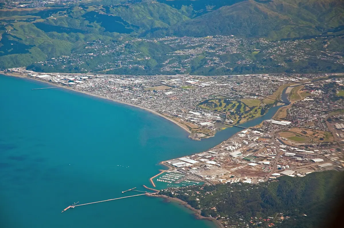
Ahead of you, the swim finishes on the shallow, welcoming sandbar of Petone Beach, a shore built up by alluvial gravels and fine silt washed down from the southern Tararua Range by the 56-kilometre Hutt River. This tranquil beach was the site of the fortified Māori pā settlements of Pito-one and Hikoikoi when the first organized boatload of European settlers arrived ashore aboard the immigrant ship Aurora in January 1840. In 1855, the catastrophic Wairarapa earthquake struck the harbour, sending a three-to-four-metre tsunami surging over the sands and permanently lifting the entire Petone foreshore by more than a metre out of the water. Today, the Petone Foreshore is an open, grassy coastal strip that hums with relaxed seaside recreation throughout the summer months.
Right along the esplanade, swimmers can drink pure, untamed subterranean water from the Te Puna Wai Ora public fountain, an artesian spring filtered naturally through the alluvial gravels of the valley. An old-fashioned floating wooden swim raft is moored offshore every season between Labour Weekend and Easter, providing an offshore destination for ocean bathers.
Sources: Petone · Wellington Harbour · Waiwhetu Aquifer
Course
Point-to-point swim from Matiu/Somes Island to Petone Beach.
How to get there
The adventure begins with a ferry ride from Queens Wharf or Days Bay Wharf out to Somes Island.
Somes Island Challenge
Frequently asked questions
- When is Somes Island Challenge?
- Somes Island Challenge takes place on March 7, 2027.
- What distances does Somes Island Challenge offer?
- Somes Island Challenge offers 500 m, 1.3 km, 2.5 km, and 5 km.
- Where does Somes Island Challenge take place?
- Somes Island Challenge is a sea swim. Location: Oriental Bay, Petone, Wellington, New Zealand.
Where to stay
Petone offers a blend of historic seaside cottages and modern boutique stays near the Esplanade. Expect a range of options from simple beachside hostels at $80-$120 per night to contemporary boutique hotels overlooking the harbour ranging from $200-$350 per night. Many visitors choose to stay in central Wellington, just a 15-minute drive away, where high-rise hotels provide extensive amenities for the race weekend.
Things to do nearby
Beyond the water, the Petone foreshore is ideal for walking and cycling. The area is rich in industrial heritage, with local galleries and cafes housed in converted warehouses. For those wanting more time on the water, kayak and paddleboard rentals are available for exploring the quieter coves of the harbour. Alternatively, a short trip to the nearby hills offers extensive hiking trails with panoramic views of the entire Wellington region and the South Island across the water.
Swimmers
Other races by this organiser
- Wellington Open Water SeriesWellington, NZ
Similar races


Comments
Transparency: some links on this page (stays, flights, experiences, gear) are affiliate links — if you book or buy through them, Omniathlon may earn a commission from the partner at no extra cost to you. As an Amazon Associate we earn from qualifying purchases.