
Flannagan Cup
- Feb 6, 2027
- Distances from 200m to 3.6km
At a glance
- Next edition date
- February 6, 2027
- Distances
- 200 m · 400 m · 1.2 km · 3.6 km
- Where
- Sea · Ngamotu Beach, New Plymouth, Taranaki, New Zealand
- Entry fee
- 200 m: 15 NZD · 400 m: 25 NZD · 1.2 km: 50 NZD · 3.6 km: 85 NZD
- Wetsuit
- Trophies awarded for the first non-wetsuit swimmer in the 3.6km race.
- Registration
- flannagancup.co.nz
About the race
Mount Taranaki provides a scenic backdrop along the west coast for open water swimmers gathering at Ngamotu Beach every February. The Flannagan Cup is an open water swimming race held in the sea at Ngamotu Beach, New Plymouth, in the Taranaki region of New Zealand. The tradition began in 1916, when the inaugural race saw competitors jumping off the harbour breakwater and swimming through open water across to East End. In its original format, the Flannagan Cup originated as a handicapped race, designed to give every entrant an equal shot at victory across the bay. Today, the headline distance is the 3.6-kilometre Flannagan Cup, open to swimmers aged 14 and over.
The 3.6-kilometre course consists of three laps, challenging competitors to maintain their pacing and rhythm across repeated circuits. Swimmers looking for a mid-distance challenge can choose between several 1.2-kilometre events, which are open to participants aged 10 and older. Junior athletes aged 10 to 14 compete in the Duncan Laing Memorial Race over 1.2 kilometres. The same 1.2-kilometre distance hosts the Open Race for ages 15 to 19, alongside the Masters Race for swimmers aged 20 and over. Shorter distances provide welcoming opportunities for newcomers and young swimmers alike. The 400-metre Give-it-a-go race offers a straightforward introduction to competitive sea swimming. Team racing features in the Swimming Taranaki Relay Race, where three members aged 13 and under each complete a 200-metre swim.
Sugar Loaf Islands: volcanic remnants and marine reserve
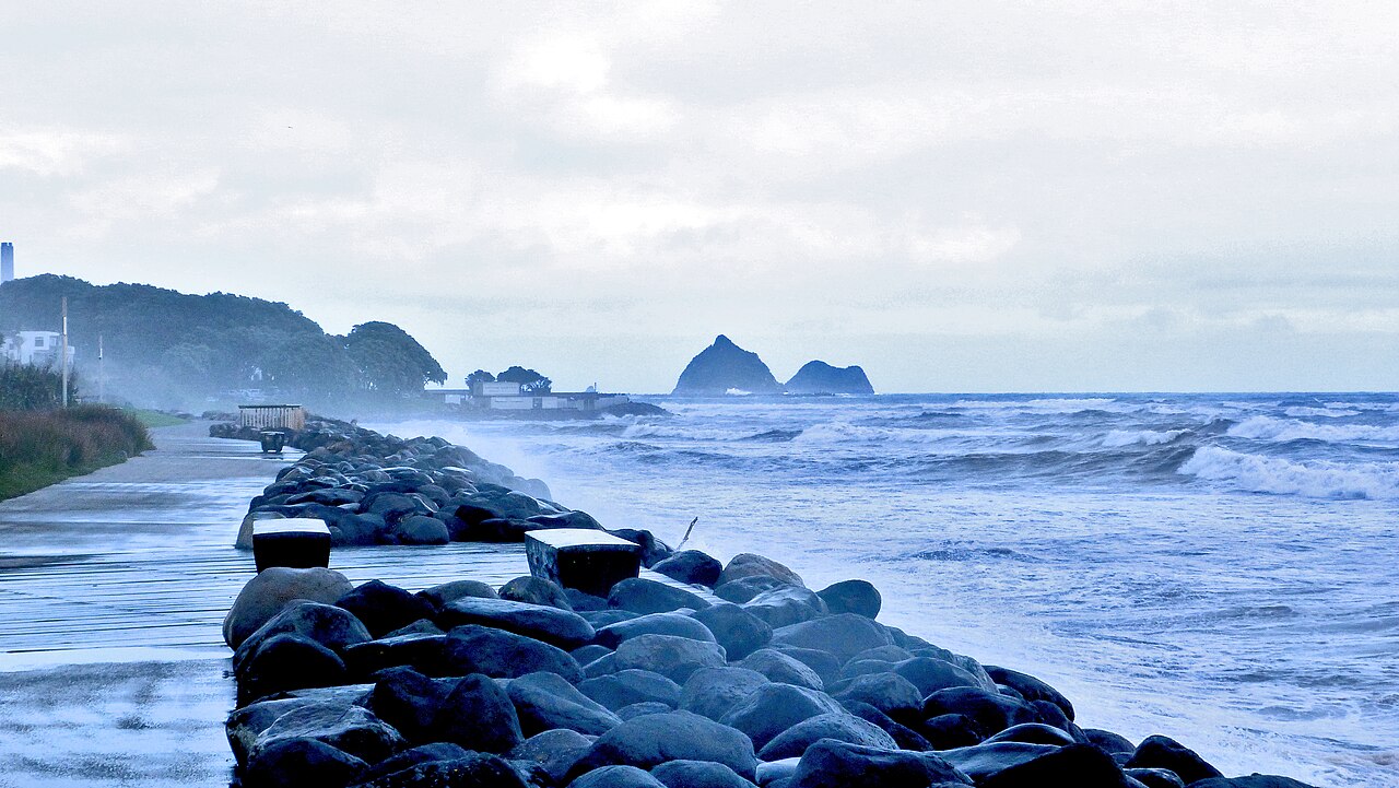
About two kilometres from the race area rise the Sugar Loaf Islands, a cluster of ancient sea stacks scattered off the coast. Captain James Cook named the group in 1770 because their distinctive shapes resembled traditional European sugar storage heaps. Geologically, these islands represent the eroded remains of volcanic vents that formed between 1.7 and 1.74 million years ago, composed of porphyritic hornblende andesite. The largest landmass in the archipelago is Moturoa, situated off the Taranaki coast about two kilometres from the beach. Moturoa is separated from the mainland by an 800-metre-wide channel, with a cluster of smaller islands including Whareumu resting 60 metres off its southwest coast. In the early 20th century, the island was subjected to heavy explosives during an engineering attempt to connect it to the mainland port.
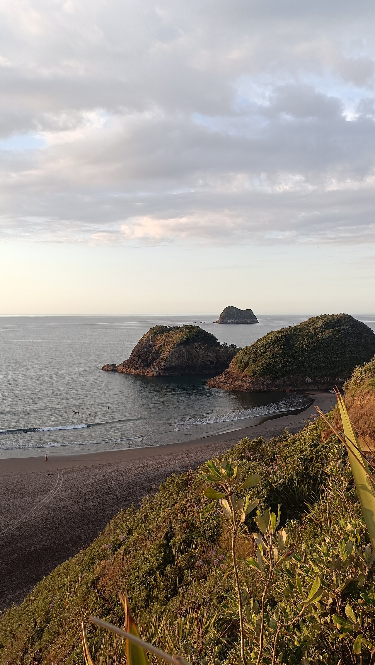
About three kilometres from the race area lies Motuotamatea, a long sloped island measuring 107 metres in length and reaching an elevation of 17 metres. Formed by volcanic activity between 1.7 and 1.74 million years ago, it is connected to the mainland by a tombolo during very low spring tides and occasionally during summer. Roughly 350 metres northwest of Motuotamatea sits the Seal Rocks cluster, which includes the rocky outcrop of Waikaranga. Further seaward, about four kilometres from the race site, Motumahanga stands as the northernmost and third largest of the Sugar Loaf Islands, composed primarily of andesite rock from the same prehistoric volcanic period. As a fully protected marine reserve, Motumahanga and the surrounding islets provide a secure environment where wildlife thrives undisturbed. Small rocks east of Motumahanga host thriving populations of birds and seals.
Port Taranaki coast: from Maori fishing to early oil
Moturoa served as a productive site for fishing and gathering for local Māori tribes across generations. Likewise, Motuotamatea provided valuable hunting, fishing, and gathering grounds for the Taranaki Iwi and Te Āti Awa tribes. The northern island of Motumahanga was also utilized for centuries by Māori tribes both for fishing expeditions and as a secure place of refuge. In 1828, Richard "Dicky" Barrett established a trading post at Ngāmotu after arriving aboard the vessel Adventure. Permanent English settlers followed on 31 March 1841, when the ship William Bryan dropped anchor off the coast to establish the new township. The nearby Paritutu Rock stood as a prominent coastal landmark. The shoreline near Ngamotu Beach also concealed an unusual geological heritage.
In 1865, thick deposits of oil were noticed directly on the beach sand, prompting the start of petroleum exploration along the coast. That same year, drillers completed the Alpha well near Mikotahi, creating one of the earliest commercial oil wells in the world.
Ngamotu Beach promenade and the Coastal Walkway
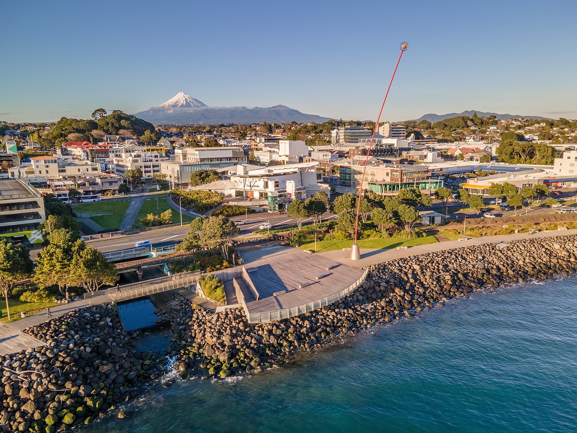
Ngamotu Beach evolved over the decades from its early industrial connections into a lively public recreation hub. In the early 20th century, the beach became a favourite holiday destination, bustling with tea rooms, roller-skating rinks, and seaside carnivals. The adjacent Lee breakwater continues to draw visitors today as a popular spot for walking, fishing, and watching vessels navigate Port Taranaki. Families gathering on race day also make use of the beachside park facilities, which include a playground centered around an eight-metre-tall waka tower. The beach marks the western starting point for the New Plymouth Coastal Walkway, a paved path designed for walking and cycling that stretches 12.7 kilometres toward Bell Block.
The trail was originally constructed in 1999 as a seven-kilometre coastal path. Local authorities extended the route by three kilometres in 2010 to connect with Bell Block, eventually bringing the walkway to its current length of 12.7 kilometres in 2014. In 2016, the network expanded further with the addition of the Mangati Pathway, linking the coastal route across Bell Block along the Mangati Reserve.
Sources: New Plymouth · New Plymouth Coastal Walkway
Course
One lap of the course, relay changeover at the start/finish line.
One lap of the course.
Three laps of the course.
Awards
- Age group awards
Trophies for male/female winners in various age categories. Club team trophies available for 3.6km and 1.2km races.
Previous editions
How to get there
New Plymouth Airport (NPL) is 15km away. There are no direct passenger trains; the site can be reached in a 20-minute drive or shuttle from the airport. Car rental is recommended to explore the region. Parking is available at the sports complex and along the coast.
Flannagan Cup
Frequently asked questions
- When is Flannagan Cup?
- Flannagan Cup takes place on February 6, 2027.
- What distances does Flannagan Cup offer?
- Flannagan Cup offers 200 m, 400 m, 1.2 km, and 3.6 km.
- How much is the entry fee for Flannagan Cup?
- Entry fees by distance: 200 m: 15 NZD · 400 m: 25 NZD · 1.2 km: 50 NZD · 3.6 km: 85 NZD. Early bird discounts up to $10 off until Dec 31st. Late entry fee of $20 applies to entries received after Jan 31st.
- Is a wetsuit required at Flannagan Cup?
- Trophies awarded for the first non-wetsuit swimmer in the 3.6km race.
- Where does Flannagan Cup take place?
- Flannagan Cup is a sea swim. Location: Ngamotu Beach, New Plymouth, Taranaki, New Zealand.
- How do I register for Flannagan Cup?
- The reference page for registering for Flannagan Cup is http://flannagancup.co.nz/event-details/.
Where to stay
New Plymouth offers a mix of accommodation styles, ranging from boutique hotels near the central business district to family-run motels along the coastal route. For those preferring a more independent stay, holiday apartments and small coastal cottages are common within a short drive of Ngamotu Beach. Prices typically range from 70 to 200 EUR per night depending on proximity to the foreshore. For more details on local stays, see our accommodation guide.
Things to do nearby
The Taranaki region is centered on the outdoor accessibility provided by the 13km coastal walkway and the rugged trails of the nearby national park. Visitors often spend the weekend exploring the local garden scene or visiting the Govett-Brewster Art Gallery. For those interested in the water beyond the race, kayak and stand-up paddleboard rentals are available for closer inspection of the Sugar Loaf Islands marine sanctuary. You can find more suggestions for your weekend in our nearby activities section.
Swimmers
What to see around
1. Mount Taranaki (hiking/trail running), 2. Coastal Walkway (12km scenic route), 3. Pukekura Park (botanical gardens), 4. Govett-Brewster Art Gallery (contemporary art), 5. Surfing at Fitzroy Beach.
Similar races


Comments
Transparency: some links on this page (stays, flights, experiences, gear) are affiliate links — if you book or buy through them, Omniathlon may earn a commission from the partner at no extra cost to you. As an Amazon Associate we earn from qualifying purchases.