
Rangitoto Crossing
- Distances from 100m to 4.6km
At a glance
- Distances
- 100 m · 200 m · 2.3 km · 4.6 km
- Where
- Sea · St Heliers Beach, Auckland, New Zealand
- Entry fee
- 2.3 km: 75 NZD · 4.6 km: 119 NZD
- Wetsuit
- Wetsuit hire and purchase options available via official partners.
- Registration
- oceanswim.co.nz
About the race
The Rangitoto Crossing is an open water swimming race across the sea from Rangitoto Island to the city sands of St Heliers Beach in Auckland, New Zealand. Stepping ashore onto Rangitoto, swimmers look back toward Auckland across an open stretch of open ocean, the dark volcanic cone rising 260 metres straight up behind them as a dramatic starting backdrop. From the shoreline, the flagship 4.6-kilometre event strikes directly out across the blue water, guiding swimmers through the wide oceanic passage until the gently shelving sand of St Heliers draws beneath their strokes. Those seeking a shorter morning in the water can opt for the 2.3-kilometre course, while younger athletes and newcomers take on dedicated 100-metre and 200-metre dashes staged in the sheltered waters right off the mainland beach.
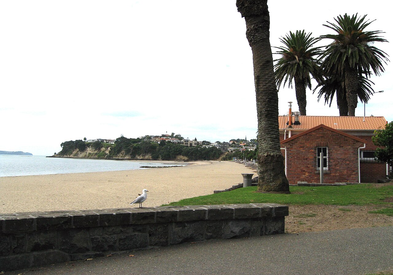
The sea in the gulf generally settles into a mild, refreshing temperature suited for sustained distance swimming, though athletes in the two longer distances must pace themselves to reach the finish arch before the midday cutoff time. Organised by the Auckland Central Masters swim club and featured as part of the nationwide New Zealand Ocean Swim Series, the gathering brings together club stalwarts, channel veterans, and travelling swimmers from across the islands.
Rangitoto Crossing: 18-19 degree water and the St Heliers finish
For the 3 May 2026 Rangitoto Crossing the event page gave the water temperature as 18-19 degrees. Swimmers in the 4.6 km crossing travel to the start by ferry. Start groups at the Rangitoto Crossing are set by the speed group each swimmer selected in the entry form, and each group wears a different coloured cap. The Rangitoto Crossing hosts the final event in Swimming NZ's Secondary School Open Water Championships. St Heliers is a seaside suburb of Auckland, located at the eastern end of Tamaki Drive. By 1890 St Heliers had become a popular waterfront destination for day trippers, with excursions running from Auckland and Thames.
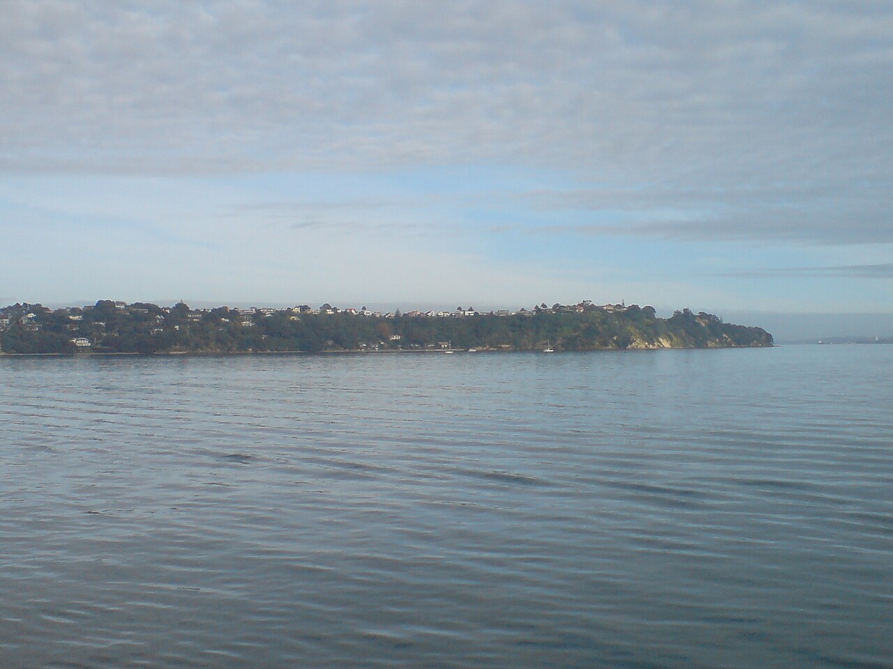
Rangitoto Island: Auckland's youngest shield volcano
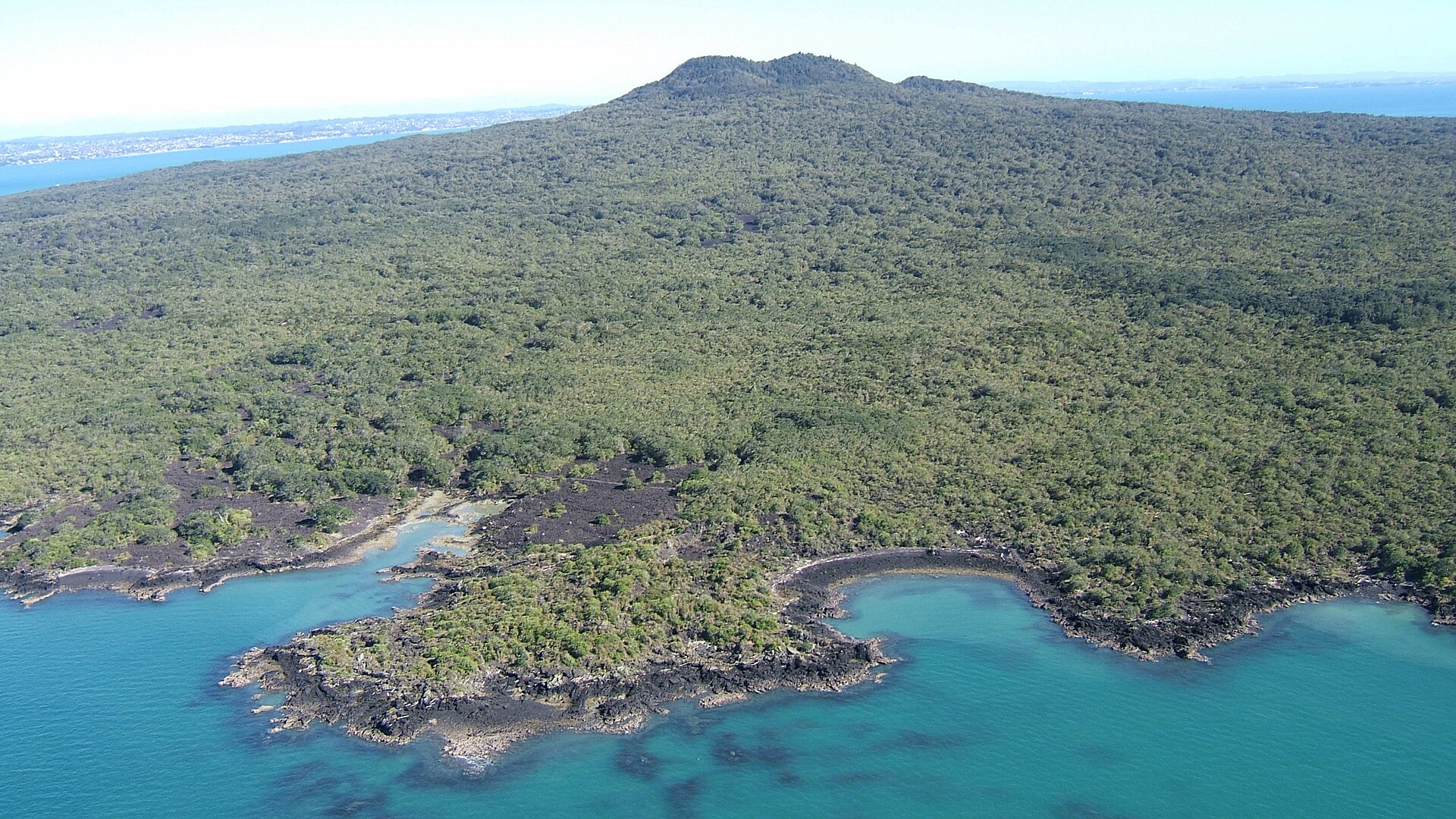
Rising to a symmetrical height of 260 metres, Rangitoto was formed in two major eruptive phases. Its dark profile is a constant reminder of the young volcanic forces that built this coast. At the water's edge, cooling pāhoehoe lava poured into the sea, forming intricate crags and extensive subterranean lava tubes that wind beneath the rocky crust. Among these subterranean volcanic conduits is a preserved tube stretching roughly 120 metres in length, carved out by rushing molten basalt before the exterior skin solidified. The jagged shoreline retains its primordial texture, providing a stark and rugged environment. Early European settlement left its own marks along this volcanic margin, including a tidal seawater pool built near the present ferry wharf. Constructed using heavy basalt stones quarried directly from the volcanic fields by convict labor, the enclosure was designed to trap clean sea water as the tide ebbed, giving visitors a sheltered bathing spot right alongside the rugged channel.
Islington Bay and the ancient footprints of Motutapu
Islington Bay is a tranquil anchorage steeped in early maritime encounters and tribal history. Long before modern vessels dropped anchor here, the bay witnessed a clash involving Tamatekapua, the renowned chief of the Te Arawa migratory canoe, who engaged the resident Tainui people on the island's shores. Centuries later, European mariners bestowed the shelter with the rough nickname Drunks Bay, using the quiet, protected water as a secluded haven where unruly crews were left to sober up before sailing into port. In the decades following the eruption, Motutapu became an active center for stonecraft and coastal manufacturing between 1400 and 1500 AD. Craftsmen harvested the tough local greywacke stone to shape adzes and edged tools.
Rangitoto Channel: the ancestral waterway to Auckland Port
The broad stretch of open sea crossed during the race follows the Rangitoto Channel, a deep trench that originated as an ancient river valley. During the Last Glacial Maximum, when sea levels sat more than one hundred metres lower than today, this maritime strait was a terrestrial gorge carved out by the prehistoric Waitematā River. As the ice melted and ocean basins flooded, the valley filled to become the primary aquatic gateway into the modern harbour. To the local Ngāi Tai people, this storied waterway is known as Te Awanui o Peretū, honoring an ancestral leader who maintained a kākā parrot reserve upon the wooded flanks of Rangitoto. It was through this expansive passage that the ancestral Tainui voyaging canoe navigated when it first explored the waters of Tāmaki Makaurau, marking the route as a vital corridor of early Polynesian navigation.
Today, the channel serves as Auckland Port's only deep-water approach route capable of accommodating large commercial vessels and ocean liners. Its strategic naval value prompted authorities in the 1880s to build major coastal defense installations along the shoreline, including artillery positions at North Head and Fort Cautley at Narrow Neck during the Russian war scare.
The ship graveyards of Wreck Bay and Motukorea
The maritime history of the gulf also rests beneath the surface along Rangitoto’s northern perimeter at Wreck Bay. Today, the skeletal iron ribs of at least thirteen scuttled vessels, including the steamships Rarawa and Duchess, emerge from the water at low tide and provide a thriving habitat for encrusting sea life and coastal fish. Motukorea's shoreline carries its own share of maritime relics, including four derelict paddle steamer hulks abandoned on its western flat by the Devonport Steam Ferry Company. Along the island's northern beach, a rugged 70-metre rock reef runs parallel to the sand, presenting a historic navigational obstacle for small boats exploring the bay. It is an unforgettable open water crossing that connects Auckland's deep volcanic foundations with the rhythm of the modern city sea.
Sources: Rangitoto Island · Rangitoto Channel · Motukorea
Course
OceanKids event at St Heliers Beach.
OceanKids event at St Heliers Beach.
Half-distance crossing finishing at St Heliers Beach.
Point-to-point crossing from Rangitoto Volcano to St Heliers Beach.
Awards
- Age group awards
4.6km: Top 3 overall and top 3 in each age group. 2.3km: Top 3 in each age group. OceanKids: Medal for all finishers.
Aid stations
Water and banana provided at the finish line.
Previous editions
Useful info
The provided page is the general home page for the New Zealand Ocean Swim Series and does not contain specific details about the Rangitoto Crossing. Registration for individual events usually opens on May 31st. It is recommended to check the specific events section on the official website once the page protection phase has ended.
How to get there
Ferry departs to Rangitoto Wharf at 7:15 AM on event day for 4.6km swimmers. No bags allowed on ferry; bag drop at ferry terminal.
Rangitoto Crossing
Frequently asked questions
- What distances does Rangitoto Crossing offer?
- Rangitoto Crossing offers 100 m, 200 m, 2.3 km, and 4.6 km.
- How much is the entry fee for Rangitoto Crossing?
- Entry fees by distance: 2.3 km: 75 NZD · 4.6 km: 119 NZD. Ferry tickets for 4.6km start are not included in the registration fee.
- Is a wetsuit required at Rangitoto Crossing?
- Wetsuit hire and purchase options available via official partners.
- Where does Rangitoto Crossing take place?
- Rangitoto Crossing is a sea swim. Location: St Heliers Beach, Auckland, New Zealand.
- How cold is the water at Rangitoto Crossing?
- The organizer states a water temperature of 18 °C (64 °F).
- How do I register for Rangitoto Crossing?
- The reference page for registering for Rangitoto Crossing is https://www.oceanswim.co.nz/pages/interislander-the-rangitoto-swim-auckland.
Where to stay
Auckland offers a range of stays near the waterfront, from high-end boutique hotels along the port and harbor-view apartments in the CBD to more modest coastal guesthouses in the Eastern Bays. Prices vary significantly by proximity to the water; expect to pay between 150 and 350 NZD per night for well-located mid-range options. During the race weekend, areas like Mission Bay and St Heliers are highly requested, so booking well in advance is recommended to ensure easy access to the finish line and early morning transport.
Things to do nearby
The weekend centers on the Hauraki Gulf, perfect for sea kayaking or SUP tours to explore the surrounding volcanic islets. Beyond the water, you can hike the summit tracks of Rangitoto to witness the island’s unique geology up close or explore the military history of the coastal defense tunnels at North Head. For a more relaxed afternoon, the local cafes along Tamaki Drive offer coastal views, while downtown Auckland provides access to extensive harbor-side dining and maritime museums detailing the city's seafaring heritage.
Swimmers
What to see around
1. Sky Tower (panoramic view), 2. Mount Eden (urban volcano trekking), 3. Waiheke Island (vineyards and beaches), 4. Auckland Domain and Auckland War Memorial Museum, 5. Viaduct Harbour (dining and nightlife).
Similar races


Comments
Transparency: some links on this page (stays, flights, experiences, gear) are affiliate links — if you book or buy through them, Omniathlon may earn a commission from the partner at no extra cost to you. As an Amazon Associate we earn from qualifying purchases.