
Powercor Lorne Pier to Pub
- Jan 9, 2027
- Distance: 1.2km
At a glance
- Next edition date
- January 9, 2027
- Distances
- 1.2 km
- Where
- Sea · Lorne Beach, Lorne, Victoria, Australia
- Entry fee
- 90 AUD
- Registration
- lornesurfclub.com.au
About the race
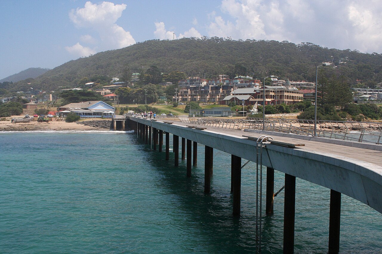
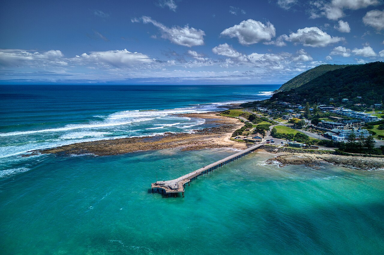
In 1981, two surf lifesavers plunged into the ocean of Lorne Pier to see if a race across the water to the beach was viable. That experimental crossing founded the Powercor Lorne Pier to Pub, an open water swimming race held in the sea at Lorne Beach on the coast of Victoria, Australia. Conceived by Lorne Surf Life Saving Club member Paul Lacey alongside Clyde Whitehand, the challenge began as an enjoyable summer swim to raise funds for volunteer lifesaving patrols. The course covers a 1.2-kilometre swim, starting in the ocean beneath the pier and finishing in front of the Lorne Surf Life Saving Club. The event takes its name from that starting structure and the Lorne Hotel, affectionately known to competitors as the pub.
Swimmers can combine the ocean crossing on Saturday with the Powercor Lorne Mountain to Surf run held in Lorne the day before during the same weekend trip. In 1998, the swim entered the Guinness Book of Records with 3,071 entrants as the largest open water swim in the world, and today the gathering draws more than 5,000 participants every January. In past editions, swimmers have enjoyed great conditions on the course, feeling the heat rise as the midsummer sun beats down across the halfway mark.
Louttit Bay and the waters of Bass Strait
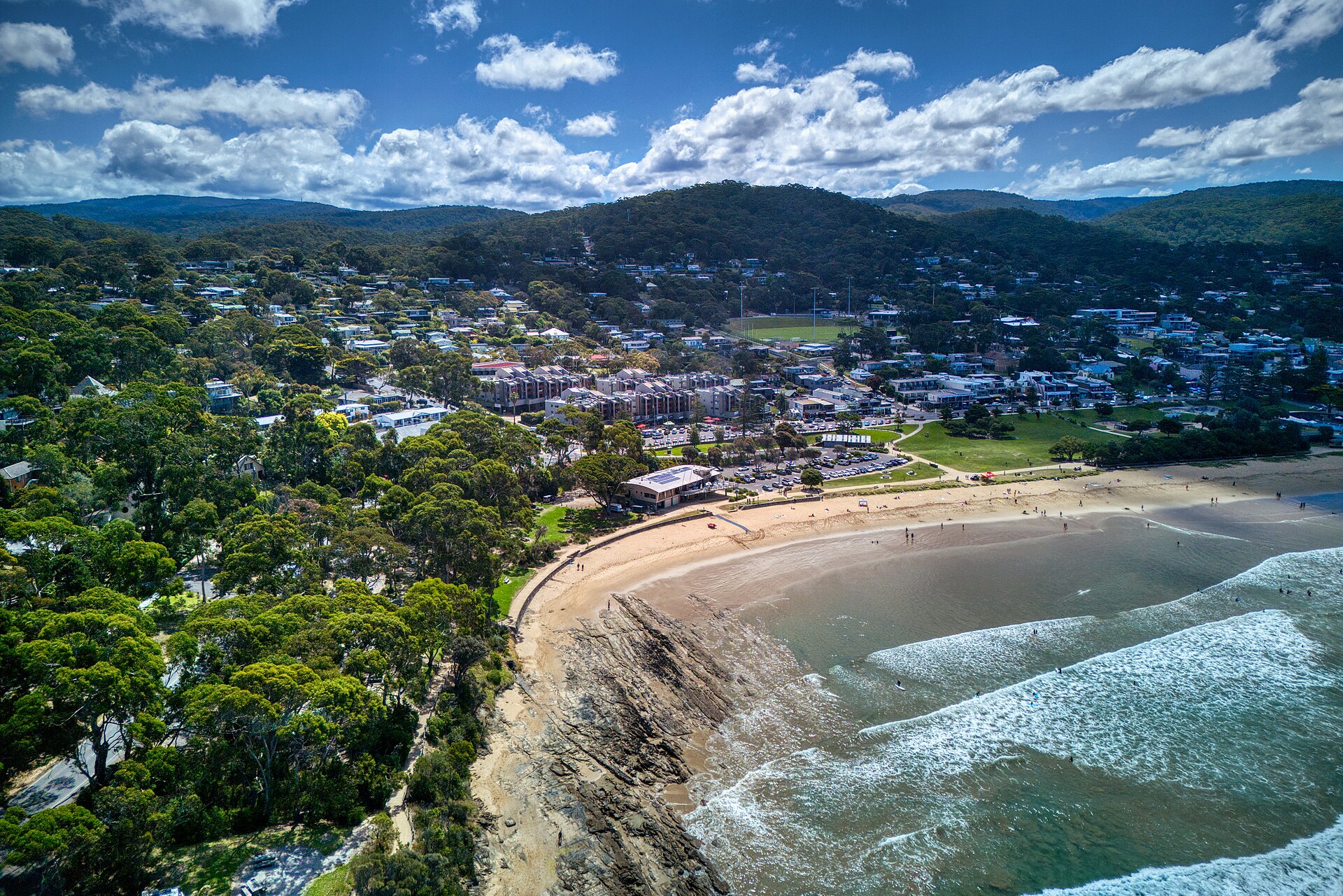
The race unfolds across Louttit Bay, a wide ocean indentation set within Bass Strait alongside the Southern Ocean. The bay takes its name from Captain Louttit, who anchored in its waters in 1841 while salvaging cargo from an offshore shipwreck. Maritime surveyors arrived to map the Lorne coastline in 1846. At the southern end of the bay, the headland of Point Grey extends outward to create a natural haven, protecting roughly 1.2 kilometres of sandy shoreline from open swells. This sheltered position makes Lorne Main Beach significantly calmer and safer for swimming than the exposed surf breaks along neighbouring stretches of coast. Summer lifeguards patrol the bathing zones at Lorne, watching for the powerful currents that can develop along open ocean beaches.
Although moving water can unsettle open water swimmers, rip currents do not pull people beneath the surface. Instead, they simply carry floating swimmers offshore, meaning anyone caught in a flow can stay safe by remaining calm and swimming parallel to the beach until free of the current. About fourteen kilometres away from the race area, the historic Split Point Lighthouse stands watch. Originally named Eagles Nest Point when constructed in 1891, the 34-metre white tower rises 66 metres above sea level to guide maritime vessels navigating between Cape Otway and the entrance of Port Phillip at Point Lonsdale.
The installation originally relied on a precision Fresnel lens manufactured by Chance Brothers in Birmingham, using red filters to signal hazardous reefs along the jagged shoreline. The light transitioned from acetylene gas in 1919 to electricity in 1972. Further along the regional coastline, exposed ocean beaches illustrate the powerful forces of the Southern Ocean swell. Fairhaven Beach extends for roughly six kilometres between the mouth of Painkalac Creek and Cinema Point, making it the longest beach on the Great Ocean Road. Facing south, it absorbs Southern Ocean swells averaging 1.5 metres in wave height across an inner and outer sandbar. As many as 20 separate rip currents can cut across its sandbars, intensifying under westerly winds and leading to the formation of the Fairhaven Surf Life Saving Club in 1957.
Down the coast at Wye River Beach, a 200-metre pocket of sand sits hemmed in by sandstone rock platforms, reefs, and headlands where 1.4-metre surf produces fierce rips. A flood in 1923 swept away its tramway bridge before storms battered the jetty, while a January flash flood washed debris from the local caravan park out through the rivermouth into the sea.
Erskine River and the Otway waterfall trails
At the northern edge of the race beach, the shoreline meets the mouth of the Erskine River, which discharges into Bass Strait east of Cape Otway. The river begins high in the forested ranges of Great Otway National Park, where rainfall feeds cascades like Erskine Falls before water winds towards the coast. About five kilometres inland from the race area, two timber splitters in the early 1870s tried to cut a path out of the dense Otway forest toward the sea. In doing so, they stumbled across Splitters Falls, a dramatic double cataract plunging 40.71 metres across separate drops of 21.60 metres and 19.11 metres. Scrambling to the base of the cascade, the woodcutters followed the stream downstream under the belief that it was the Erskine River until they walked out onto the beach at Lorne.
Their bush journey opened the hinterland to further exploration, revealing Erskine Falls, Phantom Falls, and the waterfalls threading through the Cumberland River valley. Today, a walking trail connects the base of Erskine Falls back to Lorne, leading hikers past Splitters Falls along the shaded river corridor. In the upper stretches of the Erskine River well above the waterfalls, the clear headwaters shelter a rich variety of native fish species. Other coastal rivers flow on their way to the sea. Just south of the town and northeast of Cape Otway, the St George River flows into Bass Strait, descending an impressive 585 metres along its 14-kilometre course through Port Campbell National Park.
Nearby, the Cumberland River carves a dramatic valley between the sheer stone bluffs of Langdale Pike and Castle Rock. The river finishes its journey by crossing a 200-metre sandy surf beach before emptying directly into the rolling waves of Bass Strait.
Lorne Beach foreshore and the historic pier
The race start centres on Lorne Pier, a coastal structure with two tiered platforms at its seaward head. The lower deck is frequently occupied by anglers casting lines into the ocean for whiting, trevally, and barracuda. The beachfront where competitors sprint ashore has weathered significant coastal changes since the mid-twentieth century. In 1958, public works engineers extended the shoreline seawall, but heavy storms destroyed large sections of the barrier and caused severe coastal erosion. In response, engineers built a sandstone groyne at the southern end of the beach to capture drifting sand and stabilize the shore.
Older timber groynes were later dismantled in 2005 to form a smooth, hazard-free running course for the World Surf Lifesaving Championships, creating the wide sandy expanse that greets race finishers today. Beyond the surf, Lorne Main Beach provides an ideal venue for family swimming, board paddling, and beach games. The foreshore is landscaped with broad green lawns, gum trees, and public barbecue and picnic spaces that fill with supporters on race morning. Swimmers seeking calmer water after the event can step into the Lorne Sea Baths on the promenade, which features an indoor heated pool alongside an outdoor playground. The town's cafes sit within easy walking distance of the tide line.
After running out of the surf and past the timers at the lifesaving club, competitors cross to the Lorne Hotel to celebrate another summer crossing. Sharing drinks and food while watching the ocean chop settle in Louttit Bay is the ultimate reward of a classic Australian sea swim.
Sources: Lorne, Victoria · Pier to Pub · Cumberland River (Victoria) · Erskine River · St George River (Victoria) · Splitters Falls · Lorne Beach
Course
The swim covers 1.2km starting from the Lorne Pier and finishing at the Lorne Surf Life Saving Club, located in front of the iconic Lorne Pub.
Previous editions
How to get there
Powercor Lorne Pier to Pub
Frequently asked questions
- When is Powercor Lorne Pier to Pub?
- Powercor Lorne Pier to Pub takes place on January 9, 2027.
- What distances does Powercor Lorne Pier to Pub offer?
- Powercor Lorne Pier to Pub has a single distance: 1.2 km.
- How much is the entry fee for Powercor Lorne Pier to Pub?
- The entry fee is 90 AUD.
- Where does Powercor Lorne Pier to Pub take place?
- Powercor Lorne Pier to Pub is a sea swim. Location: Lorne Beach, Lorne, Victoria, Australia.
- How do I register for Powercor Lorne Pier to Pub?
- The reference page for registering for Powercor Lorne Pier to Pub is https://lornesurfclub.com.au/pier-to-pub-events/pier-to-pub/pier-to-pub-home/.
Where to stay
Lorne offers a mix of self-contained beach cottages and boutique hotels situated near the main harbour. Camping options are available at designated sites directly facing the shoreline, providing easy access to the race start. During the January peak season, expect to pay between $250 and $450 per night for standard double occupancy in local guesthouses or apartments.
Things to do nearby
Beyond the water, the region is defined by the Otway Ranges, perfect for short coastal treks. Visitors can explore local heritage sites like the ruins of the Edna Walling property or engage in seasonal wine tastings at nearby vineyards. For those seeking a different perspective of the coastline, kayak and SUP rentals are common along the Louttit Bay waterfront, allowing for a quieter exploration of the river mouths.
Swimmers
Similar races


Comments
Transparency: some links on this page (stays, flights, experiences, gear) are affiliate links — if you book or buy through them, Omniathlon may earn a commission from the partner at no extra cost to you. As an Amazon Associate we earn from qualifying purchases.