
Open Water Bodegraven
- Jun 13, 2026
- Last edition date
- Distances from 250m to 5km
At a glance
- Last edition date
- June 13, 2026
- Distances
- 250 m · 500 m · 1 km · 2.5 km · 5 km
- Where
- River · Rijnkade 1, Bodegraven, Bodegraven, Zuid-Holland, Netherlands
- Entry fee
- 12.5–20 €
- Registration
- bzpc-bodegraven.nl
About the race
Open Water Bodegraven is an open water swimming race held in the river at Bodegraven, in the province of Zuid-Holland in the Netherlands. Swimmers assemble along the waterfront at Rijnkade, where the finish area welcomes athletes coming out of the river. Held on a Saturday in mid-June, the event is organized by the local aquatic club BZ&PC. The competition offers a versatile range of swimming distances, featuring 250 metres, 500 metres, 1 kilometre, 2.5 kilometres, and 5 kilometres. The 2.5-kilometre swim starts from the water beside Fort Wierickerschans. Taking place on a Saturday in June, the event allows traveling swimmers to cross over to the nearby Speedo Swim-in Leiden 2026, located just 14 kilometres away on the following day.
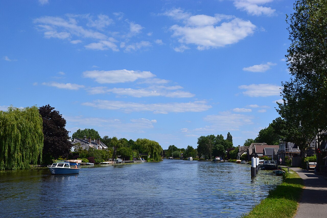
The Oude Rijn between Nieuwerbrug and the lock
The 5 km swim of Open Water Bodegraven starts in Nieuwerbrug, while the event itself takes place at Rijnkade 1 in Bodegraven. The village of Bodegraven lies on both sides of the Oude Rijn, with a lock in the middle of the village. The Beach Polo tournament of Open Water Bodegraven is played in the Oude Sluis, the old lock, open to players from 16 years of age. After a lock was built around 1350, Bodegraven had earned its place for good. In 1937 sand extraction between Nieuwerbrug and Wierickerschans turned up a Roman cavalry helmet.
Fort Wierickerschans: guarding the Old Dutch Waterline
The departure point for the 2.5-kilometre swim at Wierickerschans Fort connects swimmers to the history of the Old Dutch Waterline. The Old Dutch Waterline was a comprehensive military defense system developed to protect western Dutch cities from invaders approaching from the east. The strategy relied on flooding expansive areas of the countryside, stretching across a broad line from Muiden on the Zuiderzee down to the Biesbosch. Natural waterways presented a significant complication for the defensive line, and the river channel of the Oude Rijn was considered a notable weak point because it allowed enemy forces to bypass the flooded sectors. This defensive gap had devastating consequences in December 1672, when French troops crossed over frozen floodwaters to reach and plunder Bodegraven and Zwammerdam.
Wierickerschans Fort was constructed in 1673 specifically to close this vulnerable gap in the defenses after French forces had slipped through abandoned redoubts. Military engineers continued to modify the fortification with water infrastructure in the nineteenth century. Between 1826 and 1830, a dedicated canal was excavated directly through the fort to facilitate the safe and efficient transport of gunpowder barrels.
The Roman Limes: ancient fleet quays and buried river ships
Centuries before the Dutch water defenses were devised, the river served as the northern frontier of the Roman Empire, where the Limes cut through this lowland region. Around 94 AD, Roman workers constructed quay works along the Oude Rijn, which at the time formed the main branch of the Rhine emptying into the North Sea at Katwijk. During the Roman period, the Rhine river and its various tributaries flowed actively through the region. About five kilometres away on the south bank of the Rhine, archaeologists excavated the Roman fort of Albaniana. Excavations at the site brought to light riverbank reinforcements and wooden quays built along the river for mooring boats.
During digs conducted between 2001 and 2002, researchers also discovered official stamps of the Classis Germanica, Rome's imperial military river fleet. Albaniana was initially defended by a moated earthen rampart equipped with timber palisades, corner towers, and gates, before its wooden wall was replaced by a permanent stone wall around 160 AD. The waterlogged ground along the old riverbed provided an environment that preserved ancient wood under groundwater, river clay, and peat soil. Between 1971 and 1974, archaeologists unearthed six Roman river ships buried in the old riverbed at Zwammerdam. The discovery included three dugout canoes carved from oak along with three large flat-bottomed military transport ships. Roman soldiers used these flat-bottomed military vessels to haul stone along the Rhine, moving building bricks produced in Nijmegen and slate quarried in the Eifel region.
Further down the river, about eleven kilometres from Bodegraven, the Roman fort of Matilo stood on the southern bank of the Oude Rijn. The name Matilo is believed to have originated from a nearby water body. In 47 AD, General Gnaeus Domitius Corbulo commanded the excavation of a military canal connecting the Meuse and Rhine rivers, known as the Fossa Corbulonis. Matilo was established around 70 AD at the tactical confluence of the Oude Rijn and the Fossa Corbulonis, possibly succeeding an earlier observation watchtower. Between 130 and 196 AD, Roman forces strengthened the fort by digging three moats around the perimeter and rebuilding its armoury in stone.
The Groene Hart: polder drainage and Aarlanderveen mills
Traditional windmills form the defining features of this low-lying landscape. In Aarlanderveen, Mills Number One, Two, and Three were constructed around 1786. Mill Number Four was added in 1801 to drain a 100-hectare peat lake that had opened up due to intensive peat digging. The drainage channel even crosses over the Grote Wetering waterway through a specialized underpass built between Mill Number One and Mill Number Three. About two kilometres away, the Gouwe waterway was widened and improved in the early 1930s to allow vessels carrying up to 2,000 tons to travel through. To eliminate narrow obstacles on the Gouwe, engineers constructed the Boskoop vertical-lift bridge between 1935 and 1936. The bridge's central lifting section weighs 100 tons and was mounted between its towering uprights on September 12, 1936.
Today the structure provides three separate lifting levels for passing river craft, raising its roadway to 12, 24, or 34 meters. Beyond the towns and shipping channels, the Groene Hart features major lakes such as the Nieuwkoopse Plassen, Reeuwijkse Plassen, Kagerplassen, Langeraarse Plassen, and Braassemermeer. These wetlands and wet grasslands serve as an essential habitat for marshland birds, including the black-tailed godwit, the northern lapwing, and the Eurasian oystercatcher. Swimming between the open banks toward Rijnkade, competitors find themselves immersed in a Dutch river landscape where every mile reflects a centuries-old relationship with water.
Sources: Groene Hart · Hefbrug Boskoop
Course
Start at Fort Wiereckeschans.
Start in Nieuwerbrug.
Previous editions
Useful info
The provided webpage is the official site of the BZ&PC club and contains only general references to the 'Open Water 2026' event without technical details, logistics, costs, or specific regulations for the race.
How to get there
Airports: Amsterdam Schiphol (35km) is the closest. From the airport, there is a direct train to Bodegraven (approx. 45 min). By car: located along the A12, parking is available near the sports center/lake. The area is flat and ideal for cycling, which is the recommended way to reach the race site.
Open Water Bodegraven
Frequently asked questions
- When was the last edition of Open Water Bodegraven?
- The last edition of Open Water Bodegraven took place on June 13, 2026.
- What distances does Open Water Bodegraven offer?
- Open Water Bodegraven offers 250 m, 500 m, 1 km, 2.5 km, and 5 km.
- How much is the entry fee for Open Water Bodegraven?
- The entry fee ranges from 12.5 € to 20 €. Second distance free if participating in multiple events; pay the price of the most expensive distance.
- Where does Open Water Bodegraven take place?
- Open Water Bodegraven is a river swim. Location: Rijnkade 1, Bodegraven, Bodegraven, Zuid-Holland, Netherlands.
- How do I register for Open Water Bodegraven?
- The reference page for registering for Open Water Bodegraven is https://www.bzpc-bodegraven.nl/openwater.
Where to stay
Bodegraven features a mix of traditional Dutch guesthouses and comfortable mid-range hotels located near the Oude Rijn waterfront. For those preferring a more outdoorsy base, small-scale camping facilities are available in the surrounding polder landscape, offering quick access to the start locations in Nieuwerbrug or at the fort. Prices typically range from 70 to 130 EUR per night for a double room, depending on the proximity to the town center.
Things to do nearby
A visit to the area is incomplete without exploring the regional polders, including the lowest point of the Dutch polders near Waddinxveen, marked by the 'De Vergeten Plek' artwork. Nature enthusiasts can visit the Esveld Aceretum in nearby Boskoop, home to the world's largest collection of maples and century-old specimens. The surrounding canals are also well-suited for a relaxed afternoon of kayak or SUP exploration, allowing you to view the historic landscape from the same water level as your race.
Swimmers
What to see around
1. Gouda: historic center and cheese market (10km). 2. Kinderdijk Windmills: UNESCO site (35km). 3. Reeuwijkse Plassen: natural area for swimming and kayaking (5km). 4. Utrecht: historic city with unique canals (30km). 5. Zuid-Kennemerland National Park: dunes and wild nature (45km).
Similar races


Comments
Transparency: some links on this page (stays, flights, experiences, gear) are affiliate links — if you book or buy through them, Omniathlon may earn a commission from the partner at no extra cost to you. As an Amazon Associate we earn from qualifying purchases.