
Triangle des Eaux Bleues — Miribel
- Apr 19, 2026
- Last edition date
- Distances from 2km to 6km
At a glance
- Last edition date
- April 19, 2026
- Distances
- 2 km · 4 km · 6 km
- Where
- Lake · Lac de Miribel, plage du Fontanil, Miribel, Auvergne-Rhône-Alpes, France
- Entry fee
- 15 €
- Registration
- lyonpalme.com
About the race
The Triangle des Eaux Bleues is an open water swimming race held in the lake waters of Lac de Miribel at Miribel, in the Auvergne-Rhône-Alpes region of eastern France. Organized annually by the club Lyon Palme, the event is tailored for athletes competing with fins, welcoming both monofin and bifin racers to test their speed across the open fresh water. The competition centers entirely around the plage du Fontanil, which serves as the race hub along the shoreline. Swimmers line up to tackle a 2-kilometer triangular loop that begins and finishes near the sandy entry of the beach. Depending on the chosen challenge, participants complete the circuit once, twice, or three times to cover 2, 4, or 6 kilometers, pacing their leg drive through clear markers set across the bay.
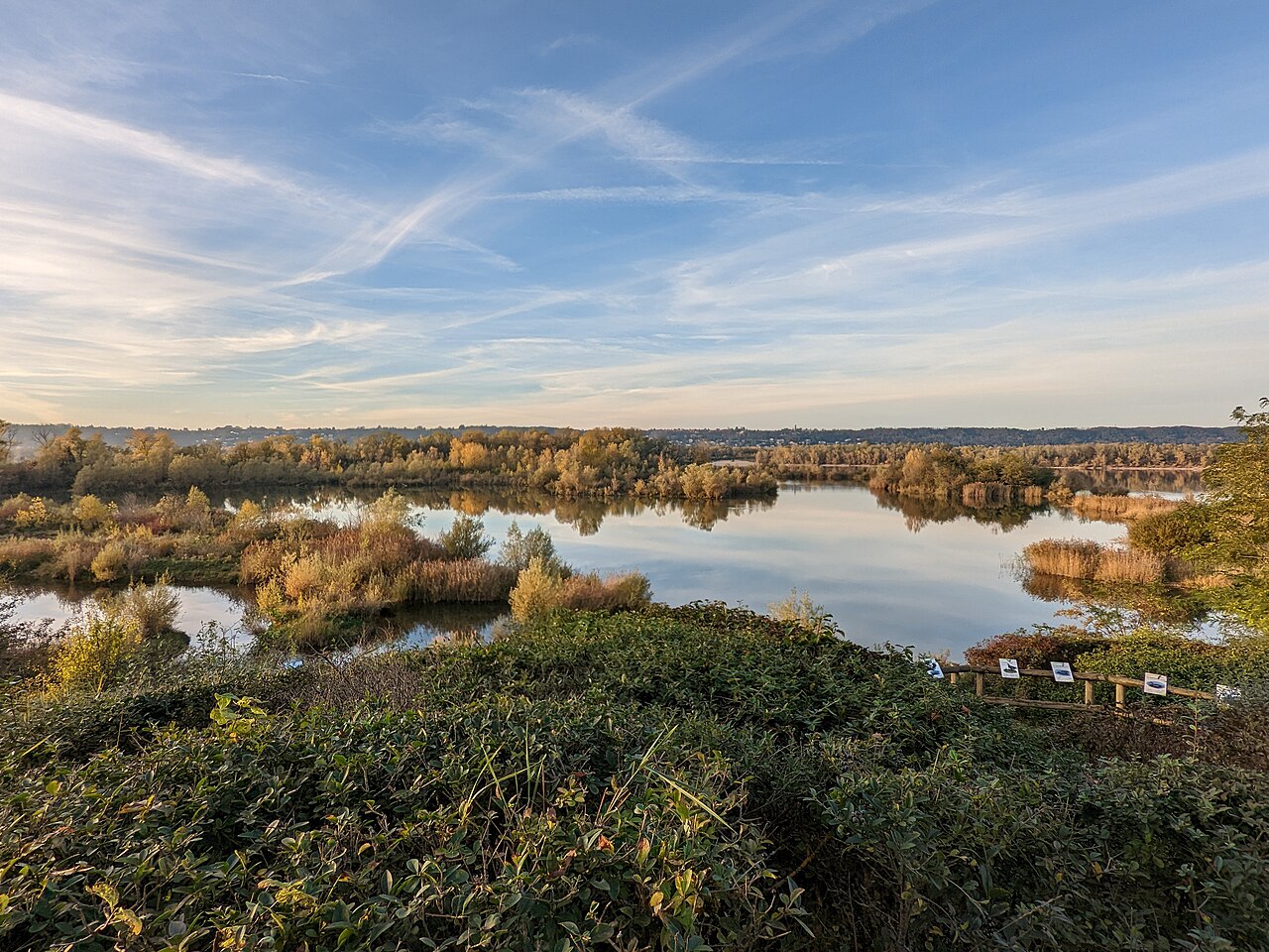
Beyond being a celebrated gathering for distance fin enthusiasts, the three distances serve as official qualifiers for the French Open Water Championship. Licensed juniors, seniors, and masters under the French underwater sports federation (FFESSM) use these laps to earn their national qualification times. In past editions, swimmers from visiting clubs have highlighted the warm camaraderie on the beach alongside pleasant swimming conditions, praising the lake's clean, clear, and well-tempered water.
Race day on the plage du Fontanil
On Sunday 19 April 2026, more than 80 swimmers started the 2, 4 and 6 km courses of the Triangle des Eaux Bleues at Lac de Miribel, swimming with fins, a monofin or floats, in mixed weather. The 2025 edition of the Triangle des Eaux Bleues brought 87 swimmers from the Auvergne-Rhône-Alpes region and from the south of France. In the 2025 photo report, the preparations on Lac de Miribel precede the warm-up entry into the water. An announcer at the microphone set the tone for the day with music. Sea rescuers of the SNSM were posted along the whole course for the swimmers’ safety. The meal on the day was lentils and sausages, prepared by two cooks at the stove.
Lac des Eaux Bleues: gravel pits and drinking reserves
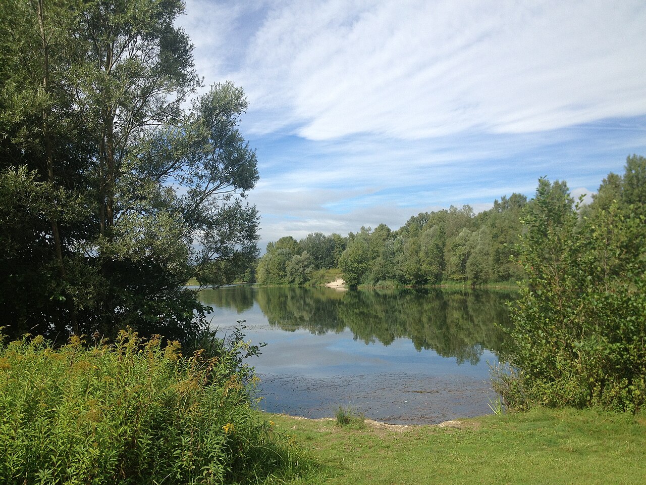
The body of water that hosts the event, Lac des Eaux Bleues, spans approximately 350 hectares of calm expanse. The lake basin took shape during the 1970s, excavated during extensive gravel quarrying operations. Beneath its recreational role, the reservoir performs critical duties for the surrounding river valley. The lake operates as a designated natural flood expansion basin for the Rhône, absorbing surging waters when seasonal spates threaten urban settlements. It also functions as a vital strategic backup supply of potable water, engineered to supply Greater Lyon with emergency drinking water in the event of accidental contamination in the main river. Surplus water from the lake drains naturally through the Vieux Rhône, the former natural river branch that once channeled the untamed waterway. Four kilometres away down the river corridor, the subterranean alluvial aquifer nourishes the Crépieux-Charmy catchment field.
Canal de Miribel: taming the braided river
Before massive engineering works transformed the basin, the Rhône river in this territory presented a wild and unpredictable landscape. Back in 1841, ordinary water stages saw the uncontained river sprawl more than three kilometers wide, meandering through gravel banks, shifting sandbars, and a maze of braided secondary channels known locally as lônes. To tame this sprawling maze, authorities began excavating the Canal de Miribel in 1848. Digging the canal took a full decade of strenuous physical labor, employing at least 500 workers along the northern flank of the alluvial flood plain. Completed in 1857, the new artificial waterway effectively channeled the northern flow, permanently locking the erratic river within uniform artificial banks.
To reinforce the raw embankments against erosion, crews planted more than 14,000 trees—including hardy acacias, mulberries, poplars, and plane trees—along the banks between 1848 and 1850. A continuous towpath was built along the right bank. With the new channel isolating the river interior, river ferries were stationed at Crépieux, Neyron, Miribel, and Thil, allowing residents and farmers to cross the deepened waterway.
Canal de Jonage and the Grand-Large basin
Four decades after the completion of the northern canal, engineers addressed the southern boundary by excavating the Canal de Jonage between 1892 and 1899. Measuring 18.85 kilometers in length, the canal was designed to redirect massive water volumes to power the Cusset hydroelectric plant in Villeurbanne. Put into service in 1897, the canal altered natural local waterways like the Rize river to supply what was then the most powerful hydroelectric facility in Europe. The completion of these two monumental channels fundamentally reshaped the geography to create a vast fluvial island. Builders created the Réservoir du Grand-Large, an artificial compensation basin designed to regulate operational water volume for the turbines downstream.
This broad water sheet remains quite shallow, with an average depth of just 1.6 meters and a maximum depth of 3.7 meters. To manage excess river energy during extreme weather events, the hydraulic network relies on the Herbens spillway to vent rising floodwaters safely away from infrastructure. The Jonage system can handle flood discharges reaching 2,500 cubic meters per second. Under such extreme conditions, selected sectors of the river island are intentionally submerged, buffering the Cusset plant and Lyon's urban districts from catastrophic river rises.
Grand Parc Miribel Jonage: islands, backwaters, and alluvial forest
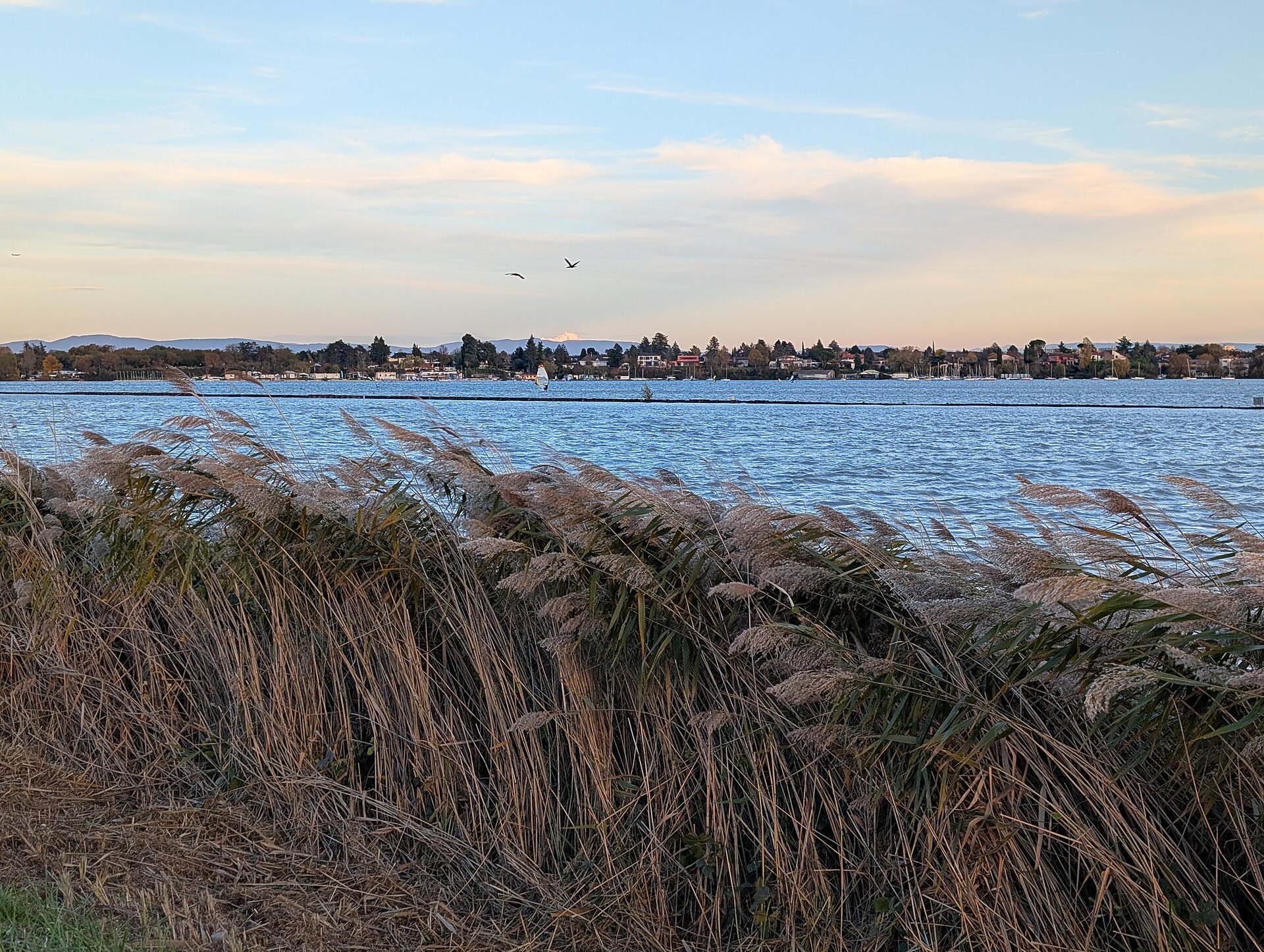
Today, 22 of the island's total 28 square kilometers form the Grand Parc de Miribel-Jonage, an extensive natural park that insulates the water body within a protected Natura 2000 perimeter. Lac des Eaux Bleues itself holds classification as a ZNIEFF Type II protected natural zone. Across the open water, several wooded islands—including Île aux Castors and Île aux Tortues—rise above the surface. Neighboring wetland habitats share a similarly rigorous conservation status. The two islands of the Crépieux-Charmy catchment area, which operated as a voluntary nature reserve until the early 2000s, have been legally shielded by an official biotope protection order (APPB) since January 2006. Six kilometres away from the race beach, within the alluvial plain where the Miribel canal runs, lies the humid woodland of La Boisse, a protected 27.72-hectare botanical site. These saturated soils nurture rare and vulnerable riparian plants, including the hastate-leaved skullcap and the angular-stemmed garlic.
Sources: Lac des Eaux Bleues · Grand Parc Miribel Jonage · Canal de Miribel
Course
A 2km triangular loop course located at Lac de Miribel, plage du Fontanil. The finish line is located near the beach.
Two laps of the 2km triangular loop course at Lac de Miribel, finishing near the plage du Fontanil.
Three laps of the 2km triangular loop course at Lac de Miribel, finishing near the plage du Fontanil.
Awards
The event serves as a departmental and regional championship for fin swimming; qualifying event for the French Open Water Championship.
How to get there
Triangle des Eaux Bleues — Miribel
Frequently asked questions
- When was the last edition of Triangle des Eaux Bleues — Miribel?
- The last edition of Triangle des Eaux Bleues — Miribel took place on April 19, 2026.
- What distances does Triangle des Eaux Bleues — Miribel offer?
- Triangle des Eaux Bleues — Miribel offers 2 km, 4 km, and 6 km.
- How much is the entry fee for Triangle des Eaux Bleues — Miribel?
- The entry fee is 15 €. Quota unica di 15 € a partecipante per tutte le distanze per i tesserati FFESSM (di cui 2 € devoluti all'associazione Palmer pour elles). I non tesserati pagano un supplemento di 4 € per la licenza giornaliera d'assicurazione (totale 19 €).
- Where does Triangle des Eaux Bleues — Miribel take place?
- Triangle des Eaux Bleues — Miribel is a lake swim. Location: Lac de Miribel, plage du Fontanil, Miribel, Auvergne-Rhône-Alpes, France.
- How do I register for Triangle des Eaux Bleues — Miribel?
- The reference page for registering for Triangle des Eaux Bleues — Miribel is https://www.lyonpalme.com/triangle-des-eaux-bleues.
Where to stay
Accommodations around Miribel consist primarily of functional hotels and seasonal campsites near the Grand Parc. For those seeking a quieter base, guesthouses in the surrounding villages provide a more local feel. Prices typically range from €70 to €130 per night depending on the proximity to the park entrance and the level of amenities offered.
Things to do nearby
The weekend offers a mix of leisure and activity. Visitors can explore the protected wetlands via kayak or SUP to get a closer look at the local biodiversity, or hike the trails along the canals. Historical walking tours of Miribel are a popular way to discover the local heritage, while the proximity to Lyon allows for easy access to world-class gastronomy and riverside wine tastings.
Swimmers
Similar races


Comments
Transparency: some links on this page (stays, flights, experiences, gear) are affiliate links — if you book or buy through them, Omniathlon may earn a commission from the partner at no extra cost to you. As an Amazon Associate we earn from qualifying purchases.