
Tegernsee Langstreckenschwimmen
- Jun 26, 2027
- Distances from 500m to 5km
At a glance
- Next edition date
- June 26, 2027
- Distances
- 500 m · 2.5 km · 5 km
- Where
- Lake · Tegernsee, Bavaria, Germany
- Entry fee
- 25–70 €
- Wetsuit
- Wetsuit rental service (arena models) is available for a fee of 30 EUR; reservation required due to limited capacity.
- Registration
- alpen-open-watercup.com
About the race
At more than seven hundred metres above sea level, the blue expanse of Lake Tegernsee rests within the dramatic heights of the Bavarian Alps. The Tegernsee Langstreckenschwimmen is an open water swimming race held in the cold, clear waters of this Alpine lake in the municipality of Rottach-Egern, Bavaria. Taking place in late June, the event gathers endurance swimmers in an alpine basin celebrated as one of the most picturesque and renowned lakes in the entire mountain region. The event hub is centered directly at the Warmbad in Rottach-Egern, an outdoor lido whose shoreline provides the setting for both the starting line and the finish arch. Since its introduction, this venue layout allows spectators to follow competitors closely as they plunge into the water and navigate along the buoys.
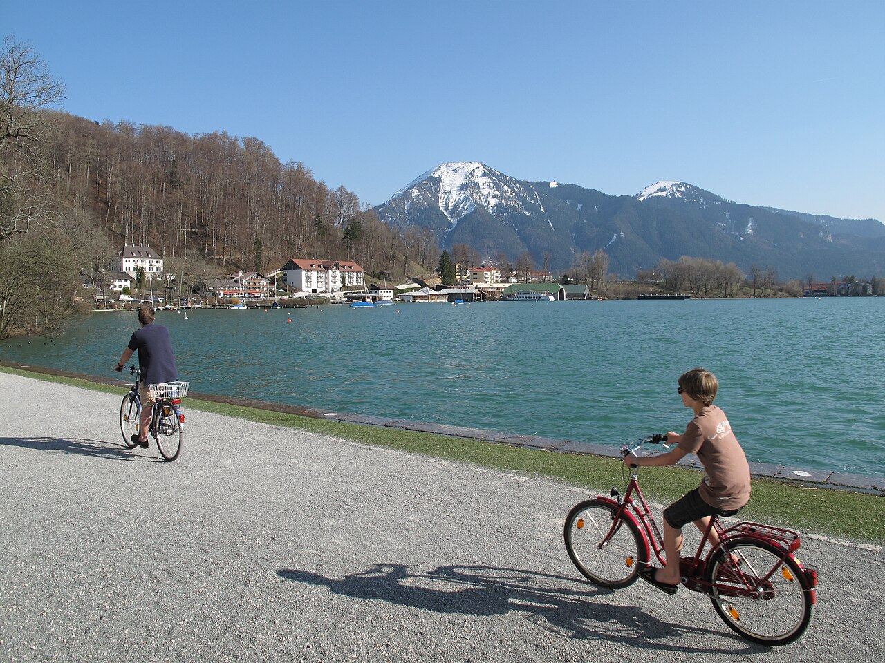
Swimmers can choose between distances of 500 metres, 2,500 metres, and a demanding 5,000-metre course. The 5-kilometre route serves as a marquee leg of the regional Alpen-Open-Water-Cup series. The event was originally founded by former triathlete Markus Füller, who organized the inaugural crossing of the lake in September 2018. The race atmosphere is defined by the shifting moods of high-altitude mountain weather. In earlier editions, rainy conditions have seen the lake water register at 17.5 degrees Celsius, while crisp morning air temperatures have dipped as low as 13 degrees. Under bright summer skies, however, the water can warm up toward 21 degrees, creating smooth conditions surrounded by a panoramic view of the peaks.
Out on the course, swimmers must remain mindful of the elements and sight carefully against the horizon. During the early stages, the lake surface is often dark and flat, offering quiet gliding through the fresh water. On the return leg, however, the low morning sun can shine directly into the field of vision, making it challenging to sight the final turn buoys. Near the protected nature zone around the 4.2-kilometre mark, shifting winds can kick up small waves that push swimmers off their line and toward the guide markers. When cold conditions push water temperatures below sixteen degrees, technical wetsuits from Arena are available to rent directly on site for the swim.
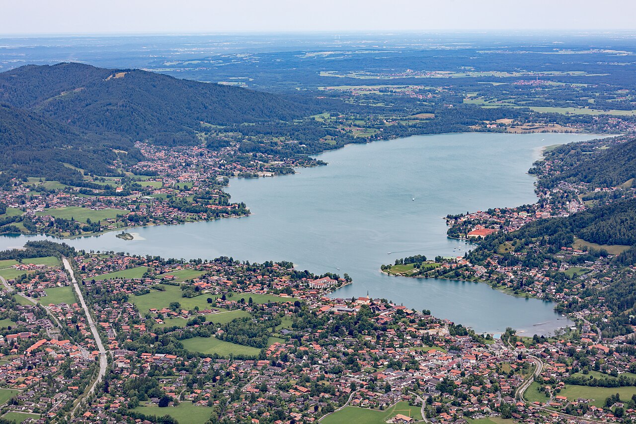
Rottach-Egern to Abwinkl: the lake course
The 2024 five-kilometre race followed a panorama course from the Warmbad in the Rottach-Egern bay to Abwinkl and back. Large yellow buoys from the Yachtclub Bad Wiessee marked the line both for the swimmers and for the lake's crossing ship traffic. Swimmers entered only in the half distance rode the Tegernsee-Schifffahrt boat from Rottach-Egern to Abwinkl and then swam the one-way route. The lake measured about 21.5 degrees Celsius that day, and the Wasserwacht Bad Wiessee provided the safety cover for the event. In 2022 the lake was just under 20 degrees Celsius as almost 100 swimmers waited in the Rottach-Egern bay for the five-kilometre start. The 2024 edition drew 240 entries, the highest number at the Tegernsee Langstreckenschwimmen since the pandemic years, and 35 women and 88 men started.
The glacial tongue basin: Lake Tegernsee and Ringseeinsel
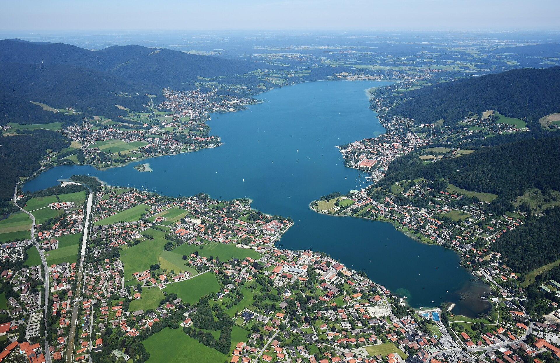
Geologically, Lake Tegernsee is classified as a classic Zungenbecken lake, formed as a tongue basin within the rugged Bavarian Alps. The lake spans a total length of 6.5 kilometres and reaches a maximum width of 1.4 kilometres across its surface. With an overall surface area of nearly nine square kilometres, it forms an expansive water body situated at 725.5 metres above sea level. The basin carries an impressive volume of water, recording an average depth of 36.3 metres and dropping down to a maximum depth of 72.6 metres in its deepest sections. The River Mangfall serves as Lake Tegernsee's outflow. In the neighboring valleys of the Mangfall and Schliersee mountains lie other high-altitude lakes that share this alpine geography.
Higher still in the Schliersee Mountains, the elevated lake of Spitzingsee sits at 1084 meters above sea level, covering 28.3 hectares across a catchment basin of 7.51 square kilometres. Its waters reach a depth of 10.4 meters in the north basin and 16.3 meters in the south basin. Back on Lake Tegernsee, the only island within the entire basin is the small Ringseeinsel, measuring approximately one hundred metres long and seventy metres wide. During the early 1980s, heavy recreational activity and unregulated foot traffic caused severe shoreline erosion on Ringseeinsel. To preserve the island from degrading into the water, environmental initiatives began planting willows in 1982 to stabilize the shoreline gravel. Low gravel barriers were assembled around its perimeter to form a sheltered internal pond. Today, it shields the fragile islet, turning it into a thriving nesting and breeding refuge for water birds.
The mountain torrents: from Mount Wallberg down to the lake
The Rottach river originates on the slopes of the Rotzigmoosberg within the Mangfall mountain range. On its upper course, it flows through the mountain tarn of Suttensee before carving a steep path between the Wallberg and Bodenschneid massifs. Here, the water tumbles down through a series of small, rushing waterfalls before reaching the valley floor. The Söllbach is a 13-kilometre mountain torrent that flows into Lake Tegernsee near Bad Wiessee. It maintains a steep average gradient of roughly 76 per mille over its entire course from the high ridges. Along its journey, it picks up water from the Stinkergraben, an unusual tributary named for the sulfurous smell of its discharge spring.
Where the Söllbach discharges into Lake Tegernsee at the Abwinkel district, it has deposited a distinctive nose-shaped alluvial fan of gravel. Due to the extreme speed and force of its mountain currents, modern flood protection defenses were constructed along its lower course in 2006 and 2007. At the stream mouth, visitors will find a dedicated fish hatchery alongside a public aquarium showcasing the indigenous fish species of the lake. The Zeiselbach descends from sources situated beneath the Aueralm at an altitude of approximately 1240 meters above sea level. Before reaching the lake, the stream cuts directly through the centre of Bad Wiessee, reinforced by protective stone barriers to handle seasonal alpine runoff. Further along, the Breitenbach springs from the Breitenberg below the Huder at 1200 meters, flowing past the Finneralm alpine pasture at 830 meters before reaching its reinforced mouth.
The abbey shore and the passenger steamers of Tegernsee
Standing directly on the banks of Lake Tegernsee is the historic former Benedictine monastery of Tegernsee Abbey. High above the settlement, tucked in a hollow at the foot of Mount Wallberg, sits the isolated mountain tarn of Gloggnersee. Lying quietly within an alpine pasture, this upland water body possesses neither surface inflows nor outlets. According to local folklore, a secret treasure belonging to the monks of Tegernsee Abbey was hidden in the lake and remains buried in the mud beneath its surface. Down on Lake Tegernsee, the water remains alive with activity throughout the warm summer months. A fleet of scheduled passenger steamers operates across the surface, ferrying travelers and hikers between the different lakeside docks. Locals and travelers gather along the shorelines for recreational angling and open-air swimming in the cool mountain water. Gliding across the lake during the race offers an immersive vantage point, connecting swimmers directly to the alpine heritage and clean waters of Bavaria.
Sources: Tegernsee (lake) · Tegernsee · Breitenbach (Tegernsee)
Course
Previous editions
How to get there
Munich Airport (MUC) 85 km away. Tegernsee train station (BRB line from Munich Hbf, 1h). By car: A8 motorway, Holzkirchen exit, then B318/B307. Parking available at the lido (Seeglas) or Tegernsee town center; public transport is recommended due to heavy traffic during events.
Tegernsee Langstreckenschwimmen
Frequently asked questions
- When is Tegernsee Langstreckenschwimmen?
- Tegernsee Langstreckenschwimmen takes place on June 26, 2027.
- What distances does Tegernsee Langstreckenschwimmen offer?
- Tegernsee Langstreckenschwimmen offers 500 m, 2.5 km, and 5 km.
- How much is the entry fee for Tegernsee Langstreckenschwimmen?
- The entry fee ranges from 25 € to 70 €.
- Is a wetsuit required at Tegernsee Langstreckenschwimmen?
- Wetsuit rental service (arena models) is available for a fee of 30 EUR; reservation required due to limited capacity.
- Where does Tegernsee Langstreckenschwimmen take place?
- Tegernsee Langstreckenschwimmen is a lake swim. Location: Tegernsee, Bavaria, Germany.
- How do I register for Tegernsee Langstreckenschwimmen?
- The reference page for registering for Tegernsee Langstreckenschwimmen is https://www.alpen-open-watercup.com/.
Where to stay
The lakeside offers a mix of traditional Bavarian guesthouses, often family-run 'Gasthäuser' with historical charm, and more modern boutique hotels near the town center. Prices typically range from 120 EUR to 250 EUR per night depending on the proximity to the water. Camping options are limited but available, primarily situated further from the main swimming hubs. Many participants prefer the accommodations near the shore to minimize travel on race morning, as the start times are often early to leverage the calmest lake conditions.
Things to do nearby
Beyond the water, the region is defined by its alpine trails and cultural heritage. You can explore the network of hiking paths leading up to the Baumgartenschneid for a view of the entire valley, or visit the many local breweries and artisanal producers that dot the hillsides. For a slower pace, the lake is ideal for kayak and SUP sessions, allowing access to coves that are otherwise difficult to reach from the main roads. The local museums frequently highlight the area's long-standing connection to arts and literature.
Swimmers
What to see around
1. Ascent to Wallberg mountain (cable car or hiking) for panoramic views. 2. Herzoglich Bayerisches Brauhaus Tegernsee brewery. 3. monte mare spa in Tegernsee. 4. Hike to Neureuth. 5. Visit to the Olaf Gulbransson Museum.
Other races by this organiser
- Chiemsee LangstreckenschwimmenÜbersee, DE
Similar races


Comments
Transparency: some links on this page (stays, flights, experiences, gear) are affiliate links — if you book or buy through them, Omniathlon may earn a commission from the partner at no extra cost to you. As an Amazon Associate we earn from qualifying purchases.