
Mackinac Bridge Swim
- Jul 24, 2027
- Distance: 7.2km
At a glance
- Next edition date
- July 24, 2027
- Distances
- 7.2 km
- Where
- Lake · Straits of Mackinac, Saint Ignace, Michigan, United States
- Entry fee
- 475 USD
- Registration
- runsignup.com
About the race
Looking up at the soaring steel towers of the Mackinac Bridge while treading water in the Straits of Mackinac offers a monumental perspective granted to very few swimmers. The Mackinac Bridge Swim is an open water crossing across the deep freshwater channel separating Michigan's Upper and Lower Peninsulas, organized by I Swim for Amy INC in July. Swimmers take to the open water beneath one of the world's most famous suspension bridges, completing an epic journey across the threshold where two Great Lakes converge.
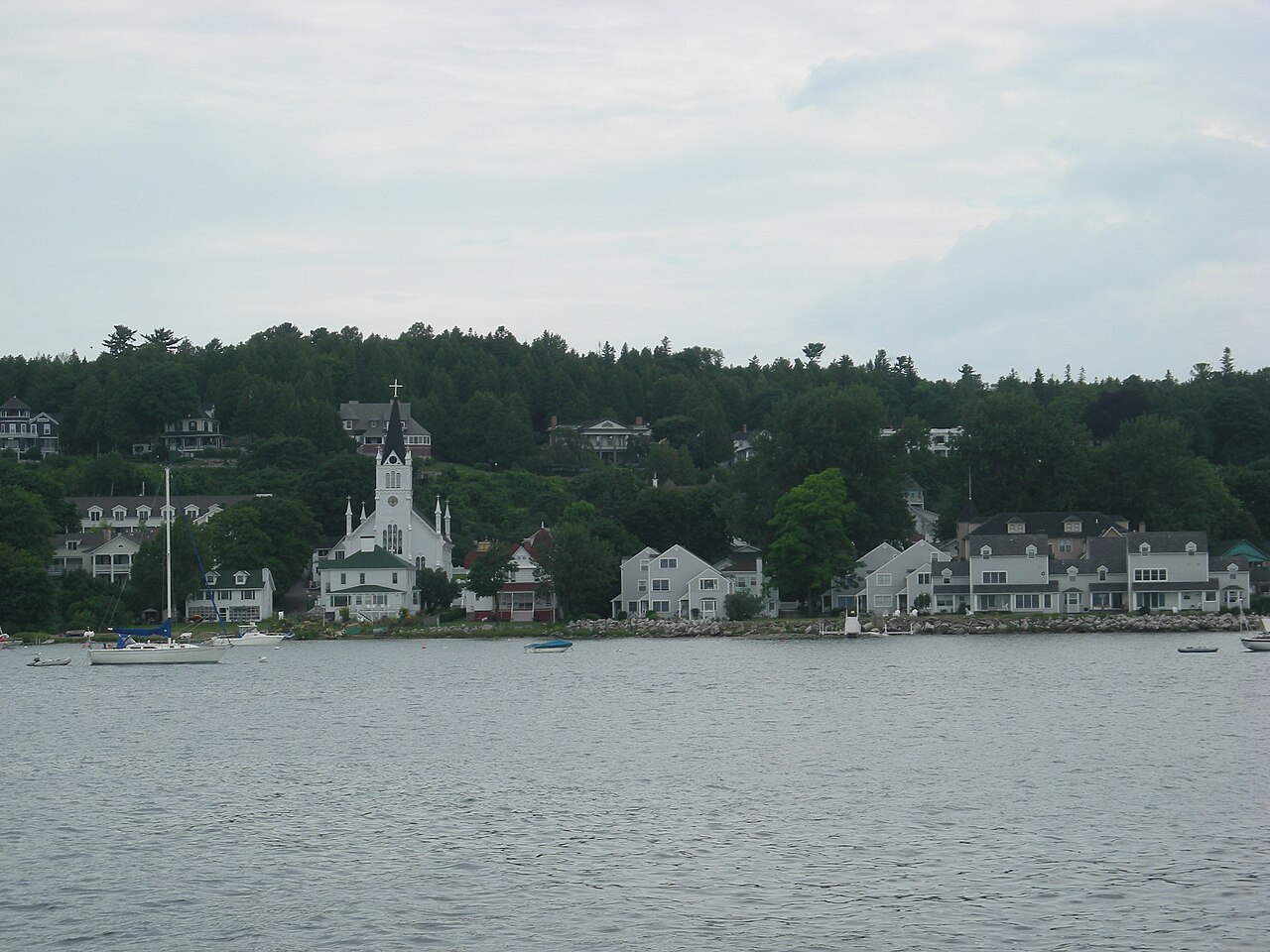
The crossing beneath Mighty Mac: Mackinaw City to St. Ignace
Swimmers set off from the southern mainland at Mackinaw City and chart a 4.5-mile course across the open strait to finish at Bridgeview Park in Saint Ignace. Conceived as an organized group swim rather than a timed competition, the event operates as a dedicated fundraiser supporting first responders across Michigan. Without the rush of a timing clock, the entire focus rests on navigating the deep lake waters alongside fellow open water enthusiasts. Safety demands strict preparation, as the water temperature in the straits generally fluctuates between 57 and 70 degrees. Every participant is required to wear a wetsuit and tow a high-visibility swim buoy, with entry open to swimmers aged 14 and older who qualify by demonstrating an authenticated pace of 40 minutes per mile or faster.
At the start line, swimmers are organized into heats designated by colored swim caps—white for the steadier pacers, blue for the mid-pack, and red for the fastest—ensuring a smooth release into the rolling waters. The open strait regularly tests technique, with participants in past editions contending with hazy weather and choppy whitecap waves reaching four feet in height. Looking up from the crest of a swell, the massive towers and suspension cables dwarf every stroke. Approaching the northern shoreline, water temperatures can drop sharply like meeting an icy wall, yet the current eases as you approach the causeway and the water feels like a warm bath the moment you step ashore.
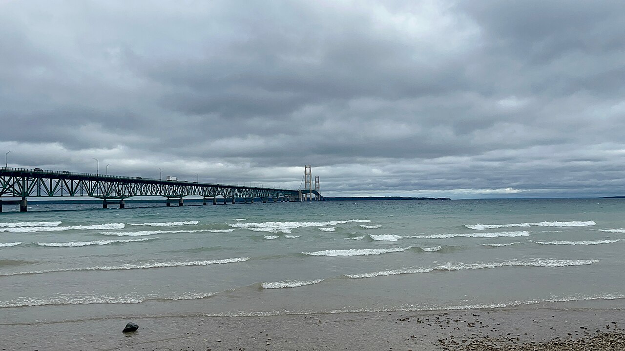
The Straits of Mackinac: where two inland seas collide
The Straits of Mackinac form a vast waterway five miles wide and up to 90 meters deep, linking Lake Michigan and Lake Huron into a single hydrological basin. The strait acts less like a simple outlet and more like a pulsing channel between two immense inland seas. Even on calm days, the aquatic environment feels untamed and vast. Beneath the surface lies a complex hydrodynamic puzzle, with currents that reverse direction approximately every day and a half. Driven by atmospheric pressure and seiches sloshing between the lake basins, water volume surging back and forth through the gap can exceed 75,000 cubic meters per second. These powerful volume shifts keep the water constantly stirred and invigorated, creating a lively environment for swimmers to read and navigate. The submarine topography tells an ancient story. Thousands of years ago, when lake levels sat much lower, the proglacial Lake Chippewa and Lake Stanley were connected through the deep Mackinac Channel.
Old Mackinac Point and the keepers of the Straits
Long before modern bridges and navigation towers arose, the indigenous Ojibwa maintained shore fires along the straits. The surrounding waterway is historically unforgiving to maritime traffic, preserved today within the Straits of Mackinac Shipwreck Preserve, which shelters numerous sunken vessels on the lake bed. To aid mariners, McGulpin Point Light was erected in 1869 about five kilometres west of the race area, surrounded by 336 feet of Lake Michigan shoreline. For decades, the lighthouse keeper James Davenport provided essential observations on ice pack conditions each spring, signaling when the straits were clear enough for commercial shipping to resume after freezing solid during deep winter. About three kilometres from the starting area stands Old Mackinac Point Light, its 45-foot cylindrical tower constructed from Cream City brick and Indiana limestone upon a solid ashlar foundation.
The station was famed for a steam-driven fog signal that once consumed 52 cords of stove wood in just two weeks of heavy weather, guiding iconic railroad car ferries like the SS Chief Wawatam and SS Sainte Marie through zero-visibility conditions across the passage.
Mackinac and St. Helena: from Devil's Kitchen to island shoals
Mackinac Island is an ancient limestone landmass sculpted around 13,000 BC by melting glaciers atop bedrock that dates back more than 400 million years. Indigenous fishermen frequented its shores as early as AD 900. Across the island are breathtaking geological monuments, such as Arch Rock perched 146 feet above the ground, and the stacked caverns of Devil's Kitchen, carved out of brecciated limestone cliffs by Lake Huron waves during the post-glacial Nipissing epoch. Looking west into the Lake Michigan approach, about eleven kilometres from the crossing, lies St. Helena Island. Covering 240 acres, the island features a sheltered natural harbor along its northern shore that offered ships safe haven during southwesterly gales.
However, shallow shoals extending into the channel proved hazardous, prompting the construction of a lighthouse in 1872 that later became the first in Michigan to be automated using an inventive sun-valve system. Nearer the span, just one mile west of the Mackinac Bridge and south of Point La Barbe, sits uninhabited Green Island. Spanning roughly 16 acres of dense thickets and windswept trees, it remains a quiet natural outpost tucked into the Lake Michigan currents.
St. Ignace waterfront: boardwalks, dunes and island ferries
At the end of the crossing, swimmers step ashore at Saint Ignace, a historic lakefront city located where Lake Huron meets Lake Michigan. The downtown boardwalk hugs the shoreline, offering open vistas toward Mackinac Island while connecting directly to the St. Ignace City Marina, home to local restaurants, shops, and dockside activity. The surrounding coast features rocky sandstone ledges shaped by long cycles of Great Lakes erosion. A short scenic drive leads to expansive sand dunes along Lake Michigan, perfect for relaxing on the soft sand or taking an easy recovery dip in the open freshwater. It is the ideal vantage point to rest tired shoulders, look back at the grand bridge spanning the horizon, and savor the crossing.
Sources: Straits of Mackinac · Lake Michigan–Huron · Old Mackinac Point Light · Green Island (Michigan)
Course
The swim spans the Straits of Mackinac, crossing the waterway beneath the Mackinac Bridge, connecting Michigan's Upper and Lower Peninsulas.
How to get there
Mackinac Bridge Swim
Frequently asked questions
- When is Mackinac Bridge Swim?
- Mackinac Bridge Swim takes place on July 24, 2027.
- What distances does Mackinac Bridge Swim offer?
- Mackinac Bridge Swim has a single distance: 7.2 km.
- How much is the entry fee for Mackinac Bridge Swim?
- The entry fee is 475 USD. Registration opens November 27, 2026. Open to ages 14+.
- Where does Mackinac Bridge Swim take place?
- Mackinac Bridge Swim is a lake swim. Location: Straits of Mackinac, Saint Ignace, Michigan, United States.
- How cold is the water at Mackinac Bridge Swim?
- The organizer states a water temperature of 17 °C (63 °F).
- How do I register for Mackinac Bridge Swim?
- The reference page for registering for Mackinac Bridge Swim is https://runsignup.com/Race/MI/SaintIgnace/MackinacBridgeSwim.
Where to stay
St. Ignace offers a mix of classic roadside motels and family-run lodges that cater to the summer transit traffic. You will find several comfortable inns located within walking distance of the ferry docks and the harbor, often featuring lakeside views of the bridge. Prices for a standard room during the peak July season typically range from $150 to $250 per night. It is advisable to book early, as the town serves as a primary gateway to the nearby islands and fills quickly.
Things to do nearby
Beyond the water, the region is defined by its maritime heritage and natural terrain. Visitors can explore the ongoing archaeological digs at the colonial forts or take a short ferry ride to Mackinac Island for bicycle tours and local fudge tastings. For those seeking active recovery, the surrounding coastline offers excellent sea kayaking opportunities, particularly in the protected bays near the Straits, while the trails of the Upper Peninsula provide rugged hiking paths through dense northern forests.
Swimmers
Similar races


Comments
Transparency: some links on this page (stays, flights, experiences, gear) are affiliate links — if you book or buy through them, Omniathlon may earn a commission from the partner at no extra cost to you. As an Amazon Associate we earn from qualifying purchases.