
Bridge2Bridge Swim
- Jan 17, 2026
- Last edition date
- Distances from 600m to 2.5km
At a glance
- Last edition date
- January 17, 2026
- Distances
- 600 m · 900 m · 1 km · 2.5 km
- Where
- River · Howitt Park Rowing Club, Bairnsdale, Victoria, Australia
About the race
Floating downstream on the gentle summer current of the Mitchell River carries swimmers straight through the heart of Bairnsdale. The Bridge2Bridge Swim is an open water river race held on the Mitchell River at Howitt Park in Bairnsdale, Victoria. It offers a pure downstream passage through freshwater currents during the peak of the Australian summer in January. The main event follows a scenic 2.5-kilometre line that starts at Lind Bridge in Wy Yung and carries swimmers downriver to the jetty at the Howitt Park Rowing Club. Swimmers can take on the full 2.5 kilometres as solo participants, which is open to competitors aged 17 and over. The distance is also open to relay teams from age 13, divided into three consecutive legs of 600 metres, 1,000 metres, and 900 metres.
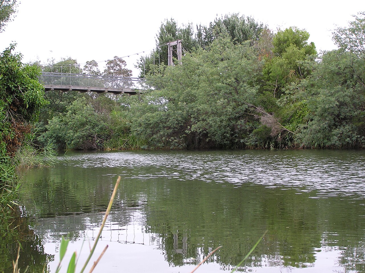
The Bridge2Bridge Splash Swim returned to Bairnsdale in 2024 after a hiatus of several years, reviving a community tradition on the Mitchell River. The atmosphere on race day is relaxed and welcoming, with locals cheering along the banks and swimmers gathering on the shaded riverside lawns of Howitt Park after the finish.
The Bridge2Bridge course from Lind Bridge to the rowing club
The Bridge2Bridge course begins at Lind Bridge and heads downstream to the Howitt Park Rail Bridge, ending at the rowing club. In the relay, the first leg is 600 metres from Lind Bridge to the Dog Hole, the second is one kilometre to the Port of Bairnsdale, and the last is 900 metres to the finish. Wetsuits are allowed on the Mitchell River course, and swim caps must be worn, preferably a bright colour for visibility. The organisers describe the swim as heading downstream, hopefully with a flow, and then under the Rail Bridge before the finish at the rowing club landing.
The Mitchell River silt jetties into Lake King
Downstream from the finish at Howitt Park, the Mitchell River winds past Bairnsdale toward Lake King and Jones Bay, feeding the lake system together with the Tambo and Nicholson Rivers. About eight kilometres downriver from the race area, sediment deposited over thousands of years has created the Mitchell River silt jetties. This classic digitate delta formation is recognized as one of the finest natural examples of its kind in the world. These remarkable long, narrow silt banks extend for more than eight kilometres straight into Lake King. At Eagle Point, towering red limestone cliffs look down across the Mitchell River where the southern bank continues out toward Point Dawson.
The south jetty bank is accessible by car, giving visitors a route alongside the water where wild kangaroos are frequently seen along the grassy strips. {{h2:Riverine Street poplars and the Macleod Morass wetlands}} Along Riverine Street, bordering the Mitchell River, a large colony of nationally threatened grey-headed flying foxes roosts high up in the canopy of poplar trees. As the silt jetties formed over millennia, they enclosed and sheltered the adjacent shallows, creating the Macleod Morass wetland right beside the river system. Across the water near Paynesville sits Raymond Island, measuring six kilometres long by two kilometres wide and lying only 200 metres offshore. In 1953, koalas were introduced to Raymond Island.
Punt Flat flood history and the traditional rivers
Historic flood events hit Bairnsdale in 1870 and again in 1893–94, with the later surge cresting 76 millimetres higher than the 1870 level. Today, Punt Flat is peaceful and calm, and the river flows steadily as an easy, scenic open water swimming corridor. The surrounding Gippsland basin is fed by neighboring waterways. The Nicholson River descends 440 metres over a total course of 83 kilometres on its way to Lake King. In the Tatungalung language, the river is named Ngarrak walang, meaning "back-stone," and its traditional Aboriginal names also include Yowen-burrun and Dart'yung, meaning "root of water plant." Upstream, the Nicholson River Dam created a reservoir that supplied town water to Lakes Entrance until 1995. Rising in the Victorian Alps, the Tambo River runs for more than 186 kilometres before emptying into Lake King, taking its name from an Aboriginal Ngarigo word meaning "fish."
Sources: Bairnsdale
Course
Leg 1 of the team relay: from Lind Bridge, Wy Yung to Dog Hole.
Leg 3 of the team relay: from Port of Bairnsdale to Howitt Park Rowing Jetty.
Leg 2 of the team relay: from Dog Hole to Port of Bairnsdale.
Downstream river swim along the Mitchell River, starting at Lind Bridge, Wy Yung and finishing at the Howitt Park Rowing Club jetty.
How to get there
Bridge2Bridge Swim
Frequently asked questions
- When was the last edition of Bridge2Bridge Swim?
- The last edition of Bridge2Bridge Swim took place on January 17, 2026.
- What distances does Bridge2Bridge Swim offer?
- Bridge2Bridge Swim offers 600 m, 900 m, 1 km, and 2.5 km.
- Where does Bridge2Bridge Swim take place?
- Bridge2Bridge Swim is a river swim. Location: Howitt Park Rowing Club, Bairnsdale, Victoria, Australia.
Where to stay
Bairnsdale offers a range of stays, from classic roadside motels and historic pubs in the town center to caravan parks and camping spots along the riverbanks. For those preferring more character, there are boutique guest houses within short walking distance of the Mitchell River. Prices typically range from $120 to $220 per night, depending on proximity to the riverfront or the town’s main commercial district.
Things to do nearby
Beyond the water, the region is defined by its natural and historical accessibility. You can explore the Mitchell River by kayak or SUP to see the wetlands up close, or head north for a short hike up Mount Taylor for panoramic views of the Gippsland Lakes. For a cultural touch, the murals inside St Mary’s Church remain a significant local attraction, while the surrounding East Gippsland area offers various artisanal food and wine tastings centered around the local agricultural output.
Swimmers
Similar races


Comments
Transparency: some links on this page (stays, flights, experiences, gear) are affiliate links — if you book or buy through them, Omniathlon may earn a commission from the partner at no extra cost to you. As an Amazon Associate we earn from qualifying purchases.